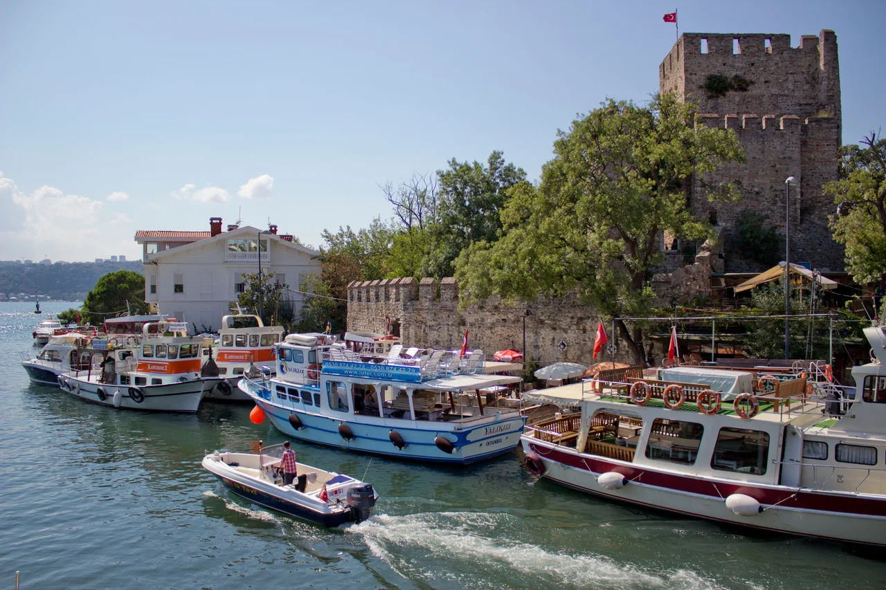

Anadoluhisarı (Fortress)
The site on which Bayezid I built his fortress in 1393–1394 had already been sacred ground for a thousand years. Beneath the foundations of the Anadoluhisarı, archaeologists found the ruins of a Roman temple dedicated to Uranus, the sky god. Bayezid was not thinking about Uranus. He was thinking about Constantinople, the great Byzantine capital visible on the European shore just 660 meters away — the narrowest point of the entire Bosphorus. The fortress he commissioned at that spot, known historically as Güzelce Hisar, 'the Beauteous Fortress,' was the first piece in an enormous strategic puzzle. It would take nearly sixty more years and the work of two more sultans before Constantinople finally fell. But the Anadoluhisarı was where the endgame began.
The Thunderbolt's Gambit
Bayezid I earned the epithet 'the Thunderbolt' for the speed of his campaigns. When he turned his attention to Constantinople around 1393, he moved with characteristic aggression. The fortress went up on 7,000 square meters of Anatolian shoreline: a 25-meter-tall quadratic main tower within an irregular pentagonal outer wall, with five watchtowers at the corners. The design was primarily functional — a watch fort, built to control the strait and cut off Constantinople's supply lines from the Black Sea. The blockade of the city began in 1394 and lasted for years. But Bayezid's campaign was derailed twice: first by the Crusade of Nicopolis in 1396, which he defeated but which pulled him westward, and then catastrophically by Timur's invasion of Anatolia. At the Battle of Ankara in 1402, Bayezid was defeated and captured. He died in captivity. Constantinople survived.
Sixty Years Later: The Fortress Finds Its Purpose
After Bayezid's defeat came eleven years of Ottoman civil war — the Interregnum — before his son Mehmed I consolidated control. The fortress sat and waited. It took Mehmed's grandson, Sultan Mehmed II, to finish what Bayezid had started. In preparation for his assault on Constantinople, Mehmed II reinforced the Anadoluhisarı with a two-meter-thick wall and three additional watchtowers, adding a warehouse and living quarters. Then, directly across the Bosphorus on the European shore, he built Rumelihisarı — a much larger fortress completed in just four months in 1452. The two structures together formed a pincer. In 1453, the year of Constantinople's fall, they throttled all maritime traffic through the strait, preventing Byzantine resupply. The city fell on May 29, 1453. Bayezid's fortress had finally served its purpose, more than half a century after it was built.
From Customs House to Cultural Monument
After the conquest, Anadoluhisarı's military function became largely ceremonial. The Ottomans repurposed it first as a customs house, then as a military prison. For several centuries it served these utilitarian roles, accumulating layers of institutional use while the world around it transformed from a besieged Byzantine city into the capital of a vast empire. Then it was simply neglected. By the time the Ottoman Empire dissolved and the Republic of Turkey was proclaimed in 1923, the fortress had fallen into significant disrepair. The Turkish Ministry of Culture undertook a major restoration between 1991 and 1993. A second restoration, conducted by the Istanbul Metropolitan Municipality, began in 2021. The fortress is a historical site today, visible from the waterfront and from the Bosphorus itself, though it is not open to the public for interior access.
The Yalı Village That Grew Around It
In an unlikely transformation, the fortress that was built to make war became the centerpiece of one of the Bosphorus's most scenic neighborhoods. The timber yalı mansions — waterside houses built by Ottoman aristocrats and wealthy families — that cluster around the fortress give the area a quality that visitors consistently describe as painterly. Old postcards from 1901 show essentially the same scene that exists today: the fortress walls rising directly from the water's edge, the wooden houses pressing close on every side, the strait gleaming behind it all. The fortress is not accessible inside, but its exterior profile — visible from ferries crossing the Bosphorus, from the Asian shore road, and from the European bank — is one of Istanbul's most recognizable waterfront images. The Göksu Stream flows into the strait just to the south of the walls, as it has since long before Bayezid arrived.
Stone Memory
Istanbul has many layers of history beneath its streets. The Anadoluhisarı is unusual in being an above-ground layer — a structure that has survived more or less intact across more than six centuries, outlasting the Byzantine Empire that it was built to destroy, outlasting the Ottoman Empire that built it, outlasting the city's transformation from imperial capital to modern megalopolis. It is officially the oldest surviving Ottoman architectural structure in Istanbul. That distinction carries weight in a city where the oldest surviving buildings are Byzantine. Bayezid I's campaign ultimately failed and he died a prisoner. His fortress endured everything that followed.
From the Air
The Anadoluhisarı fortress sits at approximately 41.082°N, 29.067°E on the Asian shore of the Bosphorus at its narrowest point — just 660 meters across to the European bank here. Viewing altitude of 1,500–3,000 feet offers a clear perspective on both the fortress and Rumelihisarı on the opposite shore, framing the strait's strategic geography. The Fatih Sultan Mehmet Bridge is visible approximately 1 km to the north. The nearest major airport is Sabiha Gökçen International (LTFJ), approximately 20 km to the southeast. From the air, look for the fortress walls at the waterline where the Göksu Stream enters the strait from the south.
Nearby Stories
- Kocaeli Peninsula 7.6 km away
- Second Battle of Çatalca 11 km away
- Istanbul's Rural Outskirts 14 km away
- MV Struma 20 km away
- HMAS AE2 36 km away
- Bursa 66 km away
- Sangarius Bridge 71 km away
- Januarius MacGahan 101 km away