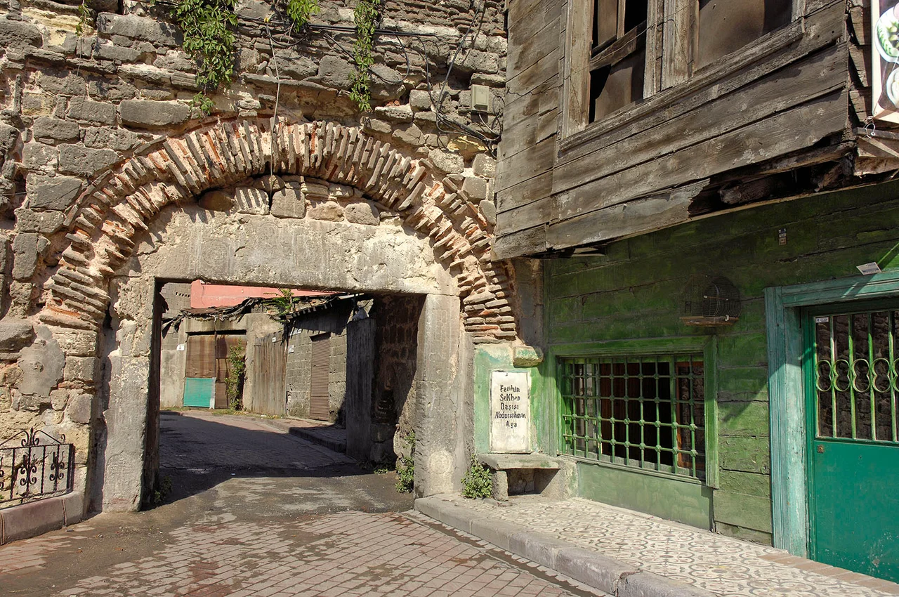

Ayakapı
The name carries two languages inside it: the Greek word for holy woman, softened into Turkish as *aya*, and the plain Turkish word for gate, *kapı*. Together they become Ayakapı — the Gate of the Female Saint — and the name alone signals how thoroughly this small quarter on Istanbul's Golden Horn absorbed one civilization into the next without losing the traces of either. The gate it describes has vanished. The saint it honors, Theodosia of Constantinople, is long dead. But the neighborhood still holds the memory of both, pressed into old stone along the water's edge.
What the Byzantines Called It
Before the Ottomans renamed it after a saint and her gate, this district bore a more prosaic Byzantine label: *ta Dexiokratiana*, meaning roughly the properties of a man named Dexiokrates. The 16th-century French geographer Petrus Gillius — who walked Constantinople obsessively and recorded what he found — identified the gate near a church dedicated to Saint Theodosia. That church is gone now. But Gillius's note preserved the connection, and the name stuck across centuries of Ottoman rule, outlasting both the gate and the building that gave it meaning.
The quarter sits inside the old walled city of Istanbul, part of the district of Fatih, with the Golden Horn lapping at its edge. In Byzantine times, this shoreline was busy and important — a protected waterway, a commercial artery, a place where the city's wealth moved in and out. Ayakapı was never the grandest district, but it was a real one, inhabited and used, and the street pattern that survives today still follows the grain of a neighborhood that has existed in one form or another for more than a thousand years.
The Mosque That Used to Be Something Else
The most significant building in Ayakapı is the Gül Mosque — one of the most important surviving Byzantine structures on the historic peninsula of Istanbul. The building is widely believed to have originally been a Byzantine church, though scholars debate its precise original dedication; the likeliest candidate is the church of Saint Theodosia herself, which would make the name-chain between saint, gate, and surviving building complete. After the Ottoman conquest of Constantinople in 1453, many Byzantine churches were converted to mosques, and this one became known eventually as the Gül Mosque — the Mosque of the Rose — a name said to derive from roses allegedly scattered there on the day the city fell.
The structure carries the characteristic marks of Byzantine ecclesiastical architecture: a weight and solidity in the stonework, proportions calculated for permanence, the kind of building that does not announce itself loudly but simply refuses to disappear. Standing in the quarter, it is impossible to miss, not because it dominates the skyline but because everything else around it is so clearly younger and smaller.
Sinan's Bath
In 1582, the Ottoman Empire's greatest architect put his hand to Ayakapı again. Mimar Sinan — who designed the Süleymaniye Mosque, the Selimiye Mosque in Edirne, and hundreds of other buildings across the empire — built a Turkish bath here, the Ayakapı Hamamı. Sinan was in his nineties by then, still working, still producing. A hamam is a functional building: a place for bathing, socializing, the practical business of cleanliness in a city that required it. Sinan's hamams were also, inevitably, works of architectural intelligence.
The Ayakapı Hamamı still stands. It is not, however, being used as a bathhouse. For years it has served as timber storage — a use as practical as its original purpose, if considerably less dignified. The building endures in the way that solid Ottoman construction tends to endure: quietly, without much ceremony, waiting for whatever comes next.
Layers on the Golden Horn
Ayakapı today is a modest quarter of the old city, easily passed through on the way to more famous landmarks. That modesty is part of what makes it worth pausing over. Here, the layers of Istanbul's history are compressed into a short stretch of waterfront and a few old streets: a Byzantine name preserved in a Turkish one, a Byzantine church still standing as a mosque, an Ottoman hamam by the empire's greatest architect now sheltering stacked timber.
The Golden Horn itself has changed enormously — industrialized, then cleaned up, now bordered by parkland and ferry piers. But the water is still there, and the quarter still faces it, and the old stone buildings still hold their ground against the pressure of the modern city crowding in from every side. History in Istanbul doesn't end; it just changes its use.
From the Air
Ayakapı lies at approximately 41.027°N, 28.957°E on the southern shore of the Golden Horn in Istanbul's European historic peninsula. Approaching from the air, the Golden Horn estuary cuts a distinctive diagonal path inland from the Bosphorus, and Ayakapı sits at the inner bend of this waterway, just west of the Galata Bridge. The Gül Mosque's dome is visible from altitude among the dense rooflines of the Fatih district. Nearest major airport is Istanbul Airport (LTFM), approximately 35 km to the northwest. Best viewed from 1,000–2,000 feet on a clear day, looking southeast along the Golden Horn toward the Bosphorus.
Nearby Stories
- Kocaeli Peninsula 7.6 km away
- Second Battle of Çatalca 11 km away
- Istanbul's Rural Outskirts 14 km away
- MV Struma 20 km away
- HMAS AE2 36 km away
- Bursa 66 km away
- Sangarius Bridge 71 km away
- Januarius MacGahan 101 km away