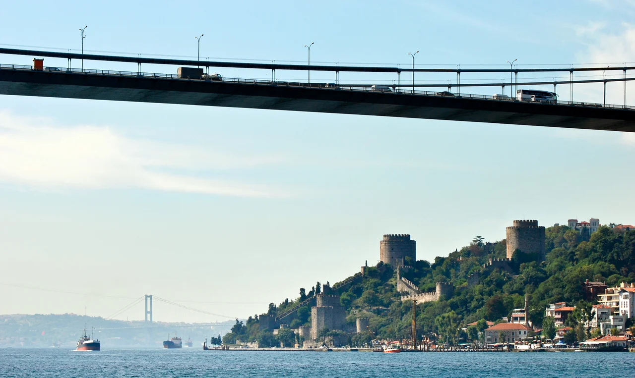

Bosporus
Seven thousand years ago, before cities, before writing, before any account we have of it, the Bosporus did not exist — at least not as a passage between seas. The Black Sea was a landlocked freshwater lake, and the narrow land bridge connecting Thrace to Anatolia held it in place. Then, as ice-age glaciers melted and Mediterranean waters rose, the barrier gave way. The hypothesis, supported by undersea explorer Robert Ballard's discovery of ancient settlements along the old shoreline, suggests a spectacular flood poured through, enlarging the Black Sea by fifty percent and driving people from its shores for months. Those refugees, the theory goes, carried the memory of a catastrophic deluge with them as they scattered across the ancient world. The Bosporus, in other words, may have generated the stories that became Noah's Ark, the Epic of Gilgamesh, and a dozen other flood traditions from cultures that never knew each other.
The Strait That Made Empires
Controlling the Bosporus meant controlling the connection between the Black Sea and the Mediterranean — and everyone who depended on that connection. Athens, which fed itself on grain from the Black Sea ports of Scythia in the 5th century BC, maintained alliances with cities that held the straits. The Persian King Darius I crossed it on a bridge of boats to pursue the Scythians into their own territory. Xerxes I built a similar bridge across the nearby Hellespont in 480 BC during his invasion of Greece. When the Roman Emperor Constantine decided in AD 330 to found a new capital, the commanding position at the mouth of the strait was central to his choice. Constantinople — the city at the crossing — became first the capital of the Eastern Roman Empire and then, after 1453, the heart of the Ottoman Empire. The Ottomans came to regard the Black Sea itself as an Ottoman lake, closed to Russian warships, a position they defended through a cascade of international treaties stretching from the 18th century through to the Montreux Convention of 1936, which governs access to the straits to this day.
Myth and Name
The name itself comes from a story. In Greek mythology, the goddess Io was transformed into a cow by Zeus, then tormented by a gadfly sent by the jealous Hera and condemned to wander the earth. She reached this narrow strait, crossed it, and there met the Titan Prometheus, who told her she would be restored to human form by Zeus and become the ancestor of the greatest of all heroes, Heracles. Bosporus means, roughly, "cow ford" in ancient Greek. Another myth placed the Symplegades — the Clashing Rocks — at its northern entrance, great floating boulders that destroyed any ship attempting to pass. The hero Jason and the Argonauts finally broke their destructive power by sending a dove through first; when the rocks clashed on the dove's tail feathers, the Argonauts rowed hard through the gap before the rocks could recover, and the Symplegades became fixed forever, opening the Black Sea to Greek navigation. Every culture that depended on this passage had stories to explain it.
A Waterway Alive with Risk
The Bosporus is only about 31 kilometers long, but it is not a simple channel. Its currents are treacherous, fed by the denser, saltier Mediterranean water flowing in below the surface while lighter Black Sea water flows out above — two rivers, essentially, running in opposite directions through the same gap. At Kandilli Point, a sharp bend requires a 45-degree course alteration through currents that can reach 7 knots, with sightlines completely blocked to ships approaching from the other direction. At Yeniköy, an 80-degree course alteration is required. Tankers, freighters, passenger ferries crossing between the European and Asian shores, private yachts, fishing boats — all share a waterway where the margins for error are genuinely small. Ships over 150 meters long must pre-book their passage. Those over 300 meters must follow a special clearance procedure. There is an air draft limit of 57 meters for anything hoping to pass beneath the bridges.
Villages, Mansions, and Summer Courts
For centuries the shores of the Bosporus were lined with fishing villages that could only be reached by boat — small communities, each with its character. Arnavutköy was known for strawberries; Çengelköy for sweet cucumbers. Many survive in name only, absorbed into the suburbs of greater Istanbul, their village identity preserved in the suffix -köy (village) attached to their names. Along the waterfront, Ottoman wealth built the yalı — grand wooden mansions set right at the water's edge, with private docks where caiques were moored. The oldest surviving yalı on the European shore, the Şerifler Yalı at Emirgan, dates from the 18th century. During the 19th century, foreign embassies maintained summer residences along the Bosporus to escape Constantinople's humid heat: the Austrians at Yeniköy, the Germans and British at Tarabya, the Russians and Spanish at Büyükdere. The Egyptian royal family spent summers here too, leaving behind buildings that still stand, including the ornate Khedive's Villa above Çubuklu.
Three Bridges and a New Century
For most of human history the Bosporus was crossed only by boat. The first bridge, the 1,560-meter 15th July Martyrs Bridge (originally called the Bosporus Bridge), was completed in 1973. The second, Fatih Sultan Mehmet Bridge, 1,090 meters long, followed in 1988. The third, the Yavuz Sultan Selim Bridge at 2,164 meters, opened in 2016 near the northern end of the strait. Below the surface, the Eurasia Tunnel — a 5.4-kilometer road tunnel — opened in December 2016, carrying vehicles between Kazlıçeşme on the European side and Göztepe on the Asian side. The strait remains, as it has always been, a line that the city and the world cannot stop crossing. In 2022, during the Russian invasion of Ukraine, the Bosporus reappeared in the headlines as the route by which Ukrainian grain reached the world — a reminder that the strategic stakes first understood by Athenian grain merchants and Persian kings have not diminished.
From the Air
The Bosporus runs roughly north-south at approximately 41.12°N, 29.08°E, stretching from the Black Sea in the north to the Sea of Marmara in the south. From the air at 5,000–8,000 feet, the strait is unmistakable — a thin ribbon of blue-gray water dividing the dense urban fabric of Istanbul on both shores. The three suspension bridges are the clearest visual landmarks, strung across the water at intervals. Istanbul Airport (LTFM) lies on the European side approximately 35 km northwest of the strait's midpoint; approach and departure paths frequently offer direct views of the Bosporus below. Sabiha Gökçen Airport (LTFJ) on the Asian shore lies approximately 20 km southeast of the strait. Prevailing winds are from the northeast (Poyraz) in summer; visibility is generally excellent from late spring through early autumn.
Nearby Stories
- Kocaeli Peninsula 7.6 km away
- Second Battle of Çatalca 11 km away
- Istanbul's Rural Outskirts 14 km away
- MV Struma 20 km away
- HMAS AE2 36 km away
- Bursa 66 km away
- Sangarius Bridge 71 km away
- Januarius MacGahan 101 km away