
Byzantium
The name comes, or so the legend says, from a man named Byzas — a king of Megara who led colonists east in the seventh century BCE to found a city at the mouth of the Black Sea. Whether Byzas was real or invented, the geography he chose was not. The peninsula jutting into the water where the Bosphorus meets the Sea of Marmara is defensible on three sides by water, commands the only sea route between the Mediterranean and the Black Sea, and catches trade winds that made it a natural harbor. Whoever held this ground held the passage. That fact would shape the next twenty-seven centuries.
The Greek City at the Strait
Greeks from Megara colonized the site in the seventh century BCE, establishing Byzantion — the Greek name, later Latinized to Byzantium. The city's founding name may be Thracian in origin, possibly derived from the word for 'he-goat,' though the etymology remains uncertain; before the Greeks arrived, there was likely already a Thracian settlement here called Lygos. What made the new colony distinctive was not any cultural ambition but pure commercial logic: Byzantium sat at the Black Sea's only entrance, controlling passage for grain ships moving south from the grain-rich lands around the Black Sea toward the Greek world. The city grew wealthy from tolls and trade. It also grew embattled. Persia seized it during Darius I's Scythian campaign in 513 BCE, making it an Achaemenid port on the European Bosphorus shore. Sparta captured it in 411 BCE as part of a strategy to cut off Athens's grain supply; Athens retook it in 408 BCE. The city's location made it indispensable and perpetually contested.
Philip's Night Attack and the Goddess of Light
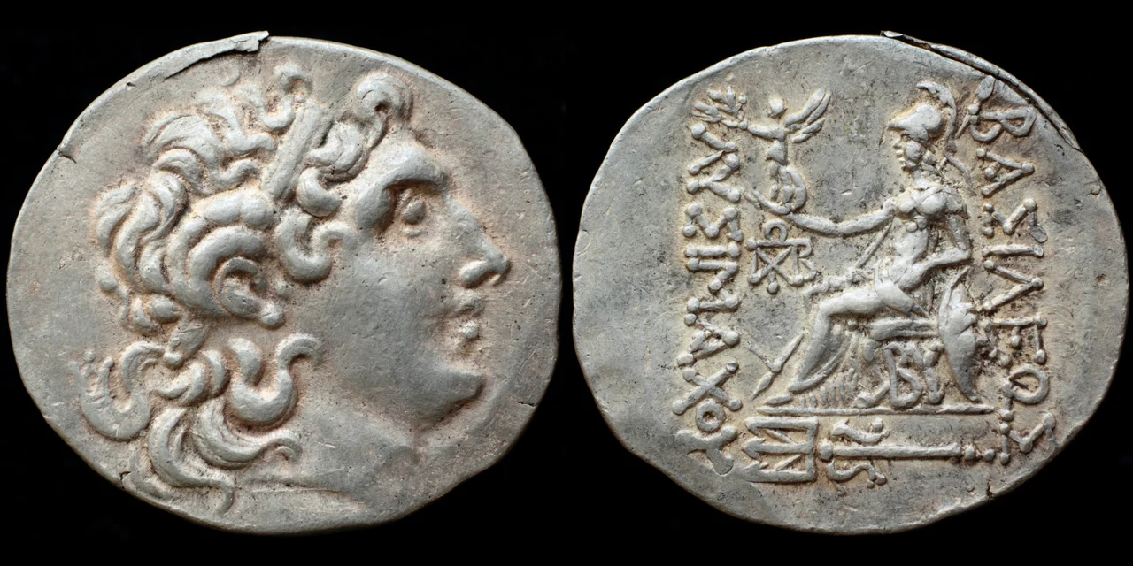
In 340 BCE, Philip of Macedon — father of Alexander the Great — besieged Byzantium. One night, attempting a surprise assault under cover of darkness, his forces were thwarted by a sudden light in the sky. Ancient accounts describe it as a bright illumination, variously interpreted by later writers as a meteor, the moon, or something stranger. The Byzantines credited the goddess Hecate, patroness of crossroads and torchlight, and erected a statue to her as Hecate lampadephoros — the light-bearer. Her symbols, the crescent and star, became associated with the city. By the early Roman period, coins from Byzantium showed Artemis's head alongside that crescent-and-star motif on the reverse. The same symbol would eventually, through routes still debated by historians, come to represent Islam on flags and coinage across the world — but its oldest recorded association is with this Greek city's gratitude to a goddess who, its citizens believed, once saved them from a Macedonian king.
The City That Rome Rebuilt
Byzantium remained a Greek city through the Hellenistic and early Roman periods, prosperous and frequently bruised. In 196 CE, it backed the wrong side in a Roman civil war — supporting Pescennius Niger against the ultimately victorious Septimius Severus — and paid for it when Severus besieged and severely damaged the city. He rebuilt it afterward; the city's strategic value made abandoning it unthinkable. Caracalla, Severus's son, later pressured his father to restore Byzantium's city status and privileges, and in gratitude the Byzantines named Caracalla an archon — a civic honor that tells you something about how these ancient city-states navigated power. The city had been doing this kind of political maneuvering for centuries. Surrounded by water, it learned to survive through accommodation as much as resistance.
Constantine's Reinvention
In 330 CE, the Roman emperor Constantine I refounded Byzantium as his imperial capital, calling it Nova Roma — New Rome. The old name persisted colloquially; so did the shape of the peninsula. Constantine chose this site for the same reasons Byzas had: defensibility, command of sea routes, and the nexus between Europe and Asia. He enlarged the city, added walls, built forums and churches, and brought the machinery of empire — senate, courts, chariot races — to the Bosphorus shore. Later it would be called Constantinople, the city of Constantine. Still later, Istanbul. Through all these names, the underlying geography has been the constant: the same peninsula, the same water, the same strategic position that a Greek colonist from Megara identified as worth founding a city on, sometime around the seventh century BCE.
Layers of a Name
The name Byzantium never entirely disappeared, even as the city accumulated new identities. Byzantine gold coins were called Byzantius in Latin from the ninth century onward, giving Western European languages the words besant, bisante, and bezant for Byzantine currency. The historian Hieronymus Wolf introduced 'Byzantine' as a term for the Eastern Roman Empire in 1557, a century after that empire had ended — a posthumous renaming that stuck. Istanbul itself derives from the Greek phrase 'eis tin polin,' meaning 'to the city,' or 'in the city' — a phrase so ubiquitous that it became the city's name, formally adopted in 1930. The city has been called Lygos, Byzantion, Byzantium, Nova Roma, Constantinople, and Istanbul. Each name is a layer. Beneath them all, on the tip of that peninsula between two seas, is the place the Megarian colonists found and decided was worth staying.
From the Air
Ancient Byzantium occupied the tip of the peninsula at approximately 41.013°N, 28.984°E — the Sarayburnu headland (Seraglio Point) where the Bosphorus meets the Golden Horn and the Sea of Marmara. From the air, this triangular peninsula is the most distinctive geographic feature of Istanbul: water on three sides, the land boundary defined by walls that have existed in various forms since antiquity. Topkapi Palace now occupies the site of the ancient acropolis. The Bosphorus Strait — the narrow waterway Byzantium was founded to control — is clearly visible from cruising altitude, separating Europe (west) from Asia (east). Nearest major airport is Istanbul Airport (LTFM), approximately 35 km northwest. Approaching from the west, the peninsula appears as a densely packed urban triangle surrounded by water on three sides — exactly the strategic geometry that drew colonists here in the seventh century BCE.
Nearby Stories
- Kocaeli Peninsula 7.6 km away
- Second Battle of Çatalca 11 km away
- Istanbul's Rural Outskirts 14 km away
- MV Struma 20 km away
- HMAS AE2 36 km away
- Bursa 66 km away
- Sangarius Bridge 71 km away
- Januarius MacGahan 101 km away