.jpg)
Cihangir
The neighbourhood was named for a dead boy. Şehzade Cihangir — the youngest and most beloved son of Suleiman the Magnificent — died in 1553, and his grief-stricken father commissioned Mimar Sinan, the empire's greatest architect, to build a mosque on the hillside above the Bosphorus in his memory. The name Cihangir derives from the Persian jahan-gir, meaning "conqueror of the world," and the irony is tender: the boy who never conquered anything has given his name to one of Istanbul's most quietly celebrated places to live.
A Prince's Hunting Ground, A City's Living Room
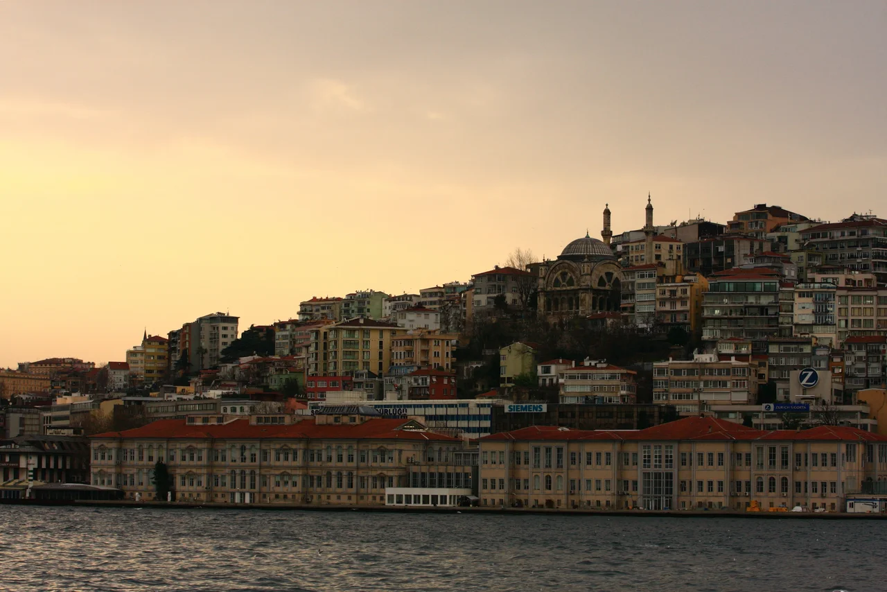
During the reign of Suleiman the Magnificent, this hillside above Tophane was forested land — a place where the sultan's sons rode out for game. Young Cihangir favoured the area, perhaps for the same reason residents love it today: the views across the Bosphorus to the Asian shore are unobstructed, the air moves freely between the hills, and the city noise softens into something tolerable. Byzantine-era Constantinople had left little mark on this slope; it sat slightly beyond the dense settlement below. The forested quiet was what made it royal hunting territory, and royal hunting territory was what made it, eventually, desirable real estate. The Cihangir Mosque, first built in 1559 and reconstructed in its current form in 1889, still stands at the top of the hill, its silhouette visible from the water. On a clear morning, looking east from the mosque's courtyard, you can see Sarayburnu — Seraglio Point — and the place where the Bosphorus opens into the Sea of Marmara.
Waves of Arrival and Departure
In the second half of the 19th century, rising rents in the nearby Pera district pushed some European residents into adjacent neighbourhoods. Cihangir drew a wave of upmarket residential construction. Then, from the 1930s onward, non-Muslim communities who had long called Beyoğlu home departed — some willingly, others under social and political pressure. Anatolian migrants arrived, and through the 1970s the neighbourhood settled into an identity it still partly carries: artists and intellectuals living alongside working-class families from the interior. Gentrification came steadily through the 2010s, accelerating the pressure on residents with modest incomes. After the Gezi Park protests of 2013 — which played out partly in the adjacent park of Taksim and drew a heavy response — some of the neighbourhood's younger bohemian population crossed the Bosphorus to Kadıköy, which offered cheaper rents and a comparable creative energy. Since 2020, that movement has reversed. Prices rose sharply again by 2021, and Cihangir's streets refilled with the cafes and bookshops and conversation that define it.
Cats, Champagne, and Comparative Literature
The 2016 documentary Kedi — which follows Istanbul's celebrated community of street cats through the eyes of the humans who feed and love them — was filmed largely in Cihangir, and it's easy to see why. The neighbourhood's steep, cobblestoned lanes, doorstep gardens, and outdoor tables create exactly the kind of half-domestic, half-wild environment where cats thrive. Turkish journalist and author Ece Temelkuran, who grew up in the area, compared Cihangir to Soho in Manhattan: a neighbourhood that functions as a kind of intellectual village within the larger metropolis. That comparison earned a local synonym. The term Cihangir solcusu — "Cihangir leftist" — entered the Turkish vernacular as the local equivalent of "champagne socialist": someone of progressive politics and comfortable means, arguing about the world from a well-appointed flat with a Bosphorus view. The Guardian named Cihangir and neighbouring Çukurcuma among the five best places in the world to live in 2012, alongside Santa Cruz de Tenerife, Hamburg's Sankt Pauli district, the north coast of Maui, and Portland, Oregon — a list that speaks to what Cihangir actually is: a place that feels both cosmopolitan and deeply local at the same time.
The View From the Hill
What defines Cihangir physically is its position. The neighbourhood sits on a ridge above Tophane, angled toward the Bosphorus so that streets running east-west frame the water in the distance. The density is human-scaled — most buildings are four or five stories, late Ottoman and early-Republican residential architecture with wrought-iron balconies and stone facades. Antique shops cluster around Çukurcuma just downhill; independent cafes and small galleries occupy the streets above. In the late afternoon, when the light off the Bosphorus turns golden and the hills of Asia come into soft focus across the water, Cihangir becomes the kind of place that is very difficult to describe without sounding like you're writing a real estate listing. But the light is real, and the view is real, and the streets are steep enough that you feel the city in your legs as you walk them.
From the Air
Cihangir lies at approximately 41.034°N, 28.986°E on the European shore of Istanbul, occupying a hillside in the Beyoğlu district just west of the Bosphorus shoreline. From the air at 3,000 feet, the neighbourhood reads as a dense cluster of residential buildings descending from the Taksim–Cihangir ridge toward the waterfront at Tophane, with the Bosphorus Bridge visible to the northeast and the minarets of the Cihangir Mosque marking the upper ridge. The nearest airport is Istanbul Airport (LTFM) approximately 40 km northwest. Approach from the west along the Golden Horn gives a clear view of the European hills; approach from the Bosphorus axis at low altitude reveals the full geography of Beyoğlu's hillside neighbourhoods cascading toward the water.
Nearby Stories
- Kocaeli Peninsula 7.6 km away
- Second Battle of Çatalca 11 km away
- Istanbul's Rural Outskirts 14 km away
- MV Struma 20 km away
- HMAS AE2 36 km away
- Bursa 66 km away
- Sangarius Bridge 71 km away
- Januarius MacGahan 101 km away