
Cistern of Aspar
Aspar was not Roman. He was Alan-Gothic by ancestry, a general of extraordinary skill who served the Eastern Roman Empire for decades and accumulated enough power that emperors feared him. In 459 CE, during the reign of Emperor Marcian, Aspar and his sons Ardabur and Patricius built an open-air reservoir in the fourteenth region of Constantinople, on the eastern slope of the city's fifth hill, overlooking the Golden Horn. They called it nothing special. Historians would eventually name it after him, and spend centuries arguing about where it was.
A General Builds a Reservoir
The Cistern of Aspar was constructed in 459, during the consulship of Ricimer and Patricius — a bureaucratic date that anchors the construction to a specific political moment in the twilight of Rome's western half. Aspar was among the most powerful figures in the Eastern Empire at the time, an Alan-Gothic general whose influence over imperial appointments was such that he effectively served as kingmaker through the 450s and 460s. Building large public infrastructure was one of the ways that powerful men in late antiquity displayed their standing and civic virtue. This cistern — square in plan, 152 meters on each side, covering 23,100 square meters, with walls five meters thick using the Roman opus listatum technique that alternated five courses of brick with five courses of stone — was a serious public work. It sat in the Petrion area of the city, near monasteries and palaces that marked the neighbourhood as significant. Aspar was assassinated in 471 CE by the emperor Leo I, who had grown weary of being ruled from behind.
The Lost Cistern and the Century-Long Search
For a remarkably long time, historians knew that Constantinople had a great cistern built by Aspar, and could not agree on which of the city's many sunken rectangles it actually was. Byzantine sources described it as "large" and near the Wall of Constantine, the city's original landward boundary. Various candidates were proposed and rejected: a cistern near the Bodrum Mosque was too small and too far from the wall; one near the Gate of Adrianople was vaulted and clearly not the right structure; a third cistern southeast of the Yavuz Selim Mosque had the right dimensions but sat too far from the old wall. The identification was finally settled only in the mid-20th century. The cistern now known as Sultan Selim Çukurbostanı — named for the Yavuz Selim Mosque that stands nearby — satisfied both criteria: large, and close to the wall of Constantine. That confirmation, centuries overdue, gave the structure its correct name at last.
What the Walls Still Say
The cistern's walls, five meters thick, were built in opus listatum — five-course bands of brick alternating with five-course bands of stone, a visually striking and structurally sound technique. Portions of these walls are still partially standing around the perimeter of the site. On the inner faces, the remains of arches are visible, leading some scholars to suggest the cistern may once have been partially roofed, though the evidence remains inconclusive. The floor of the basin has a depth of between 10 and 11 meters. At its full capacity, the cistern held an enormous volume of water — a significant fraction of Constantinople's emergency supply. A legend attached itself to it over the centuries: that an underground passage once connected the cistern directly to the Hagia Sophia, about three kilometers southeast, and that this passage was sealed around the middle of the 19th century. Whether the story is true or apocryphal, it captures something real about how Byzantines imagined their city: interconnected underground, as above.
A Park Where the Water Was
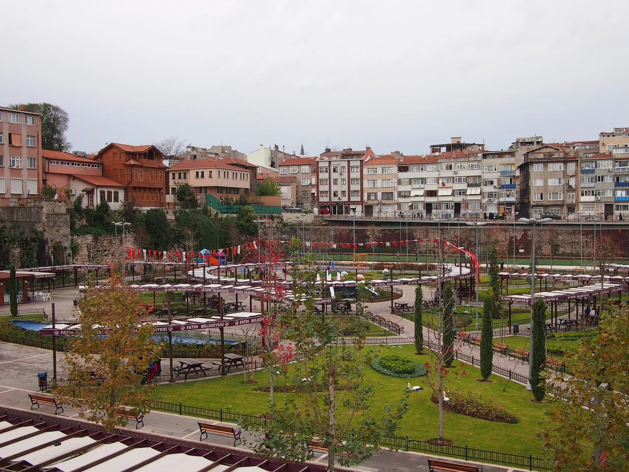
The Ottoman Turks knew this depression as Çukurbostan — sunken garden — just as they named the Cistern of Aetius. The basin made productive agricultural land once it dried out: sheltered, level, deep enough to retain moisture. By 2004, the last building in what remained of the original neighbourhood on the site had been demolished to make way for a car park. The site is now used as a park and sports fields, with the Yavuz Selim Mosque rising close by on the hill. An Education Park of the Fatih municipality occupied the grounds for a period; that use has since ended. What you find today is a somewhat ordinary recreational space — grass, walking paths, the remains of walls visible at the edges — that sits atop one of the largest water infrastructure projects the ancient world built in this city. The Golden Horn is visible from the hilltop. Looking down its length toward the Bosphorus on a clear day, you can see why this hill was where a powerful man chose to build something meant to last.
From the Air
The Cistern of Aspar is located at approximately 41.026°N, 28.950°E on the eastern slope of the fifth hill of Istanbul, in the Fener quarter of the Fatih district, on the European shore of the city. From the air at 2,500 feet, the site is identifiable as a sunken rectangular area near the Yavuz Selim Mosque — the mosque's prominent dome and minarets make it a useful aerial landmark. The Golden Horn waterway is visible to the north, with the Bosphorus visible further east. Istanbul Airport (LTFM) lies approximately 40 km to the northwest.
Nearby Stories
- Kocaeli Peninsula 7.6 km away
- Second Battle of Çatalca 11 km away
- Istanbul's Rural Outskirts 14 km away
- MV Struma 20 km away
- HMAS AE2 36 km away
- Bursa 66 km away
- Sangarius Bridge 71 km away
- Januarius MacGahan 101 km away