
Cistern of Mocius
A French traveler named Pierre Gilles arrived in Istanbul around 1540, roughly ninety years after the Ottoman conquest, and made careful notes about the city's ancient remains. When he came to the great sunken basin on the seventh hill — the one the Byzantines had built to hold water for the city's western expansion — he found it empty. The reservoir that the Patria of Constantinople credits to Emperor Anastasius I, who ruled from 491 to 518 CE, had long since dried out, its function ended, its water gone. What he described was the largest cistern that Constantinople ever built.
The Biggest Basin in the City
The Cistern of Mocius is, by the numbers, exceptional. Its rectangular basin measures 170 meters long by 147 meters wide, covering an area of 25,000 square meters — making it the largest open-air cistern ever constructed in Constantinople, larger than either the Cistern of Aetius or the Cistern of Aspar that occupied two of the city's other hills. Its walls were built six meters thick using the same Roman opus listatum brickwork-and-stone alternating pattern that appears at the other great open cisterns. The depth of the basin allowed it to hold an enormous volume of water. It sat in the twelfth region of Constantinople, on the highest part of the seventh hill — the last of the city's seven hills before the land descends toward the Sea of Marmara. Water gathered at this elevation could flow downhill by gravity into the expanding western quarters of the city.
Built for a Growing City
By the time Anastasius I commissioned this cistern in the late 5th or early 6th century, Constantinople was a century old as an imperial capital and still growing fast. The Theodosian Walls, completed in 413 CE, had pushed the city's western boundary outward from the original Wall of Constantine. The new quarters between the two walls needed water infrastructure, and the Cistern of Mocius was part of the answer. Positioned just outside the Wall of Constantine — on the edge between the old city and the new expansion — it served as a supply point for the western districts. The logic was simple: collect water from the Thracian aqueducts, store it in vast open basins at elevation, and let gravity do the distribution. By the 16th century, when Pierre Gilles walked through and took his notes, the system that logic had built was already a memory.
The Long Afterlife
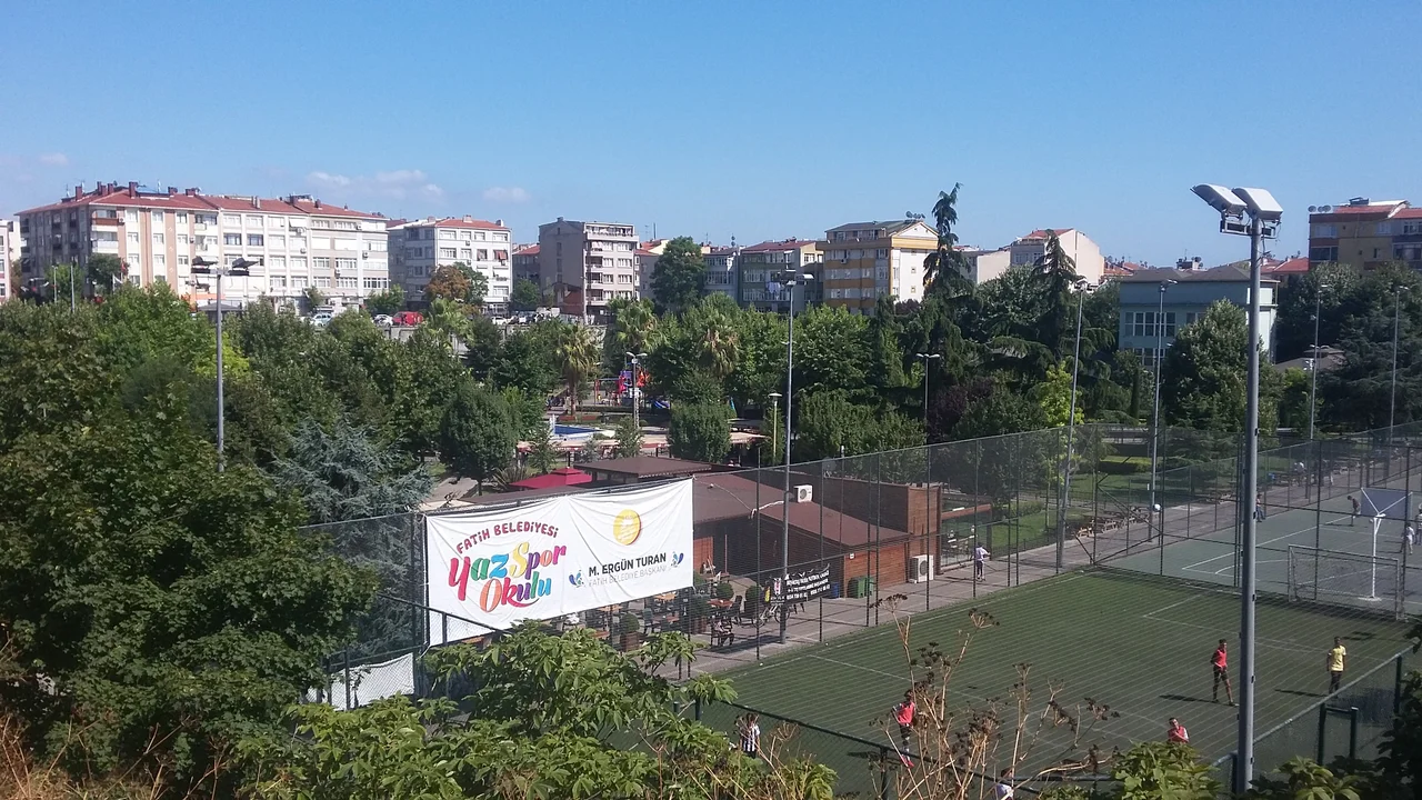
Like the other open cisterns of Constantinople, the Cistern of Mocius outlasted its function by becoming a garden. The Ottoman name Altımermer Çukurbostanı — "sunken garden of Altımermer," after the neighbourhood — followed the same naming convention as Çukurbostan for the Cisterns of Aetius and Aspar: the city's population recognized a hollow in the ground and gave it a practical name. Over the centuries, the basin floor was farmed, built upon, and eventually incorporated into the expanding urban fabric of the Fatih district. The Seyyid Ömer Mosque sits nearby to the northeast. The site is accessible from Ziya Gökalp Sokak to the north and Cevdet Paşa Caddesi to the south. At some point the municipality of Fatih converted part of the grounds into a city park — Fındıkzade Çukurbostan Şehir Parkı — and today the area serves as public recreational space within one of Istanbul's most densely settled historic neighbourhoods.
A Hilltop Above Two Seas
The seventh hill of Istanbul is the highest ground in the old walled city, and from it — on a clear day, which Istanbul provides less often than it once did — you can see the Sea of Marmara to the south and sense the Golden Horn to the north. The cistern sat at the apex of this hill deliberately: height was the point. Today the neighbourhood of Altımermer around it is a quiet residential district, somewhat removed from the tourist circuits that concentrate around Sultanahmet and the Grand Bazaar. The park occupies the former basin floor. The walls of the cistern, six meters thick, are still partially visible at the perimeter. They are made of the same Roman materials as everything else the Byzantines built to last — brick and stone in alternating courses, patient and solid, carrying the memory of a city that needed water and found a way to hold it on the highest ground it had.
From the Air
The Cistern of Mocius is located at approximately 41.010°N, 28.935°E on the seventh hill of Istanbul in the Altımermer quarter of the Fatih district, on the European shore. From the air at 2,500 feet, the site sits near the highest ground of the old walled city, with the Sea of Marmara clearly visible to the south and the silhouette of the Theodosian Walls running roughly north–south to the west. The Bosphorus is visible to the east. The nearest airport is Istanbul Airport (LTFM) approximately 42 km to the northwest. The rectangular footprint of the former cistern can be traced in the street pattern from altitude.
Nearby Stories
- Kocaeli Peninsula 7.6 km away
- Second Battle of Çatalca 11 km away
- Istanbul's Rural Outskirts 14 km away
- MV Struma 20 km away
- HMAS AE2 36 km away
- Bursa 66 km away
- Sangarius Bridge 71 km away
- Januarius MacGahan 101 km away