Dümmer
The word turns up in a Carolingian document in the year 965 - diummeri, scratched onto parchment by a scribe who probably never imagined his spelling would be argued about a thousand years later. The most likely root is the Low German dummerig, meaning damp or shadowed, fused with Meer, the old north-German word for a still water surrounded by marshland. Put together, the name means something like the shadowed sea. It fits. The Dümmer is the second-largest lake in Lower Saxony, more than 13 square kilometres of water held in a shallow basin about a metre deep on average, and even on a bright summer afternoon the colour of it is more pewter than blue.
A Lake You Could Stand In
Almost everything about the Dümmer is a function of how shallow it is. The maximum depth is just 1.5 metres. The total water surface is 13.5 square kilometres - 16 if you include the silted reed zones inside the ring dyke. It runs about five kilometres north to south and 3.4 kilometres at its widest east to west. The River Hunte, draining the Wiehen Hills to the south, flows in at one end and out at the other, although it leaves the lake via several branches and the largest of those is not called the Hunte at all but the Lohne. Other outflows carry names like the Grawiede, the Dorflohne, the Schoddenlohne, and the artificial Wätering and Ompteda Canal. About thirteen kilometres downstream, north of the town of Diepholz, all the branches reunite and the Hunte becomes one river again.
Stone Age Shores
People have been living along the edges of this water for a very long time. Archaeologists have found the remains of New Stone Age settlements in the boggy ground around the shore - settlements that date to a time when the lake was wilder, larger, and shifting its boundaries each spring. Around it now spread fens, raised bogs, reed beds, and the slow ecological gradient that connects open water to dry land. The lake sits inside the Dümmer Nature Park, which covers nearly 500 square kilometres and ties together the Damme Hills to the west, the Stemweder Berg to the east, and the wide raised bogs of the Großes Moor to the south. A bird population that includes huge concentrations of migratory geese, ducks, and waders turned the wetland into a Ramsar site, an internationally recognised wetland of importance. Almost the entire western and southern shoreline is now protected.
Dykes and the Cost of Them
For most of the lake's history, the spring floods were simply part of the calendar. The Hunte and the rich groundwater sources around the basin meant that water levels rose every wet season, the marshes spread, and the lake briefly became something much larger. In the 1940s that ended. Between 1941 and 1945, work to ring the lake with dykes was carried out on a large scale - and that work, like much wartime infrastructure in Germany, used foreign forced labour. The men and women conscripted into building those dykes have largely vanished from the lake's promotional brochures; their work, however, is still visible every time you walk the embankment. The dykes did what they were meant to do: the annual flooding stopped. But the ecological consequences came fast. Without the seasonal flush of clean floodwater, algae bloomed and starved the lake of oxygen. Silt accumulated. The shallow basin grew shallower still. A system of locks now tries to restore some of what dyking removed, but the Dümmer also has to absorb steady nutrient pollution from the surrounding intensive farms - the slow, chemical pressure of modern agriculture against an old, fragile water body.
A Place That Still Works
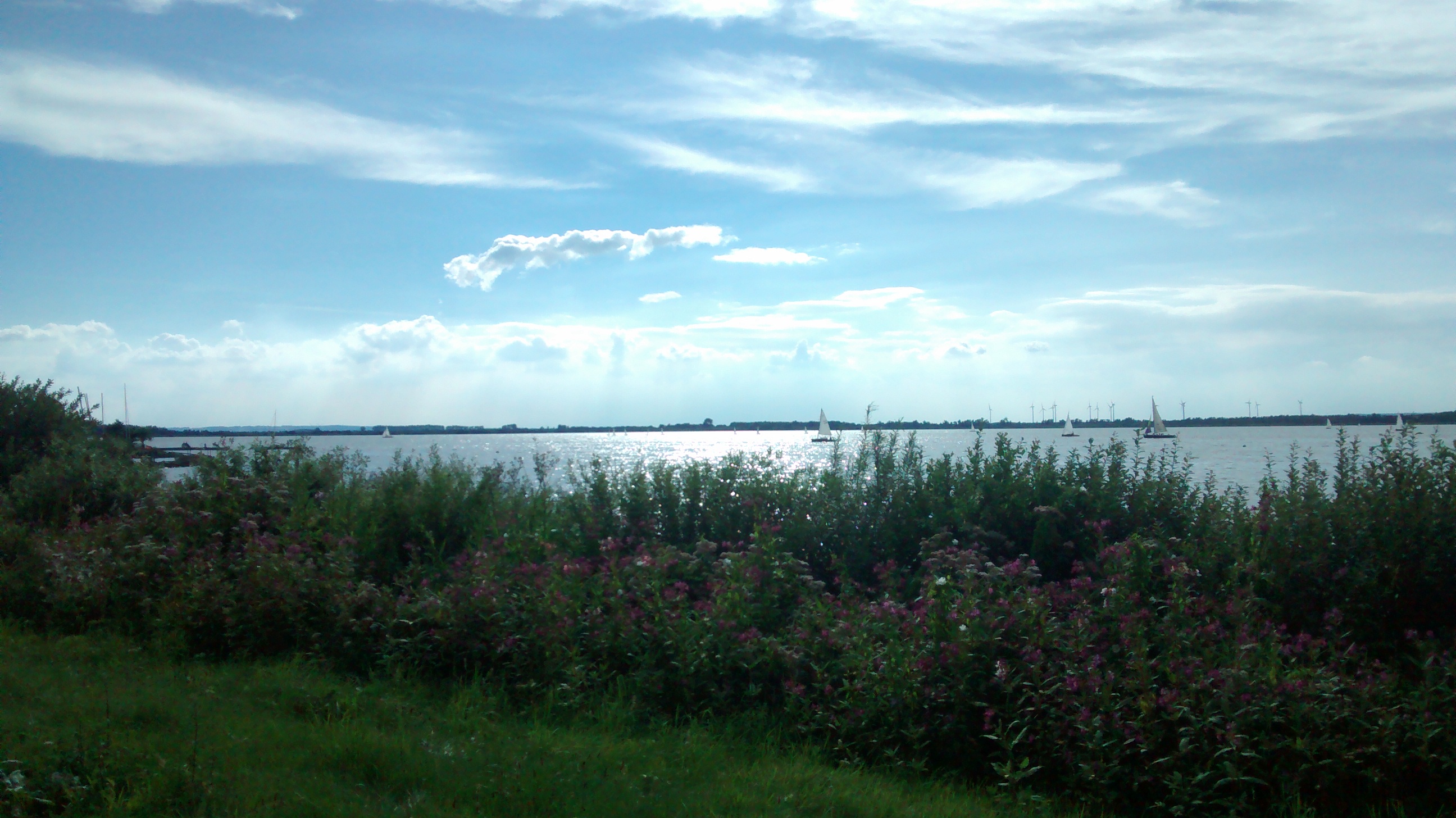
Despite all of it, the Dümmer is still a popular place to come and be on water. The flat beaches on the eastern and western shores fill in summer with swimmers and small boats. Sailing clubs use the dependable wind that crosses the open basin. Anglers come for the fish that the lake's shallow, sun-warmed water supports. Whether you stand on the dyke at Lembruch on the eastern shore or at Dümmerlohausen on the western edge, the view is the same: a sheet of bright water set against the low green wall of the Damme Hills, with reed beds running out into the middle distance and clouds of birds rising and settling all afternoon. The lake's name still means what it has always meant - the shadowed sea - and the shadow part still feels right.
From the Air
The Dümmer lies at 52.5 degrees N, 8.35 degrees E in southern Lower Saxony, on the boundary between the districts of Diepholz and Vechta. From altitude it appears as an oval, pale sheet of water about 5 km long, distinctive because it is so much shallower and more reed-fringed than other lakes in the region. The Damme Hills rise as a dark wooded ridge a few kilometres to the west; the Großes Moor lies to the south, the Stemweder Berg to the east. Nearest major airports are Münster Osnabrück International (EDDG) about 55 km south-southwest and Bremen (EDDW) about 65 km north-northeast. Best viewing altitude 3,000-5,000 feet; the lake is one of the clearest landmarks in this part of the North German Plain.