
Minden
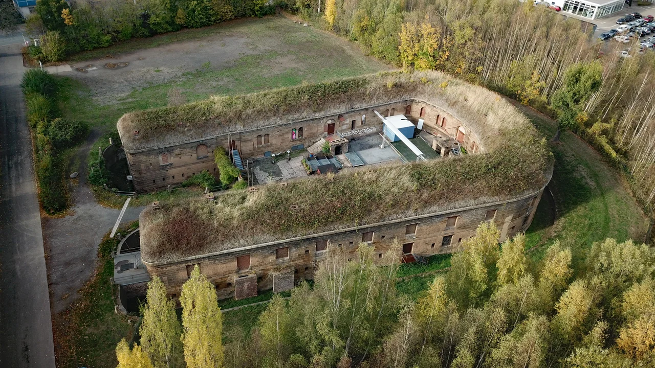
Prussian fortress regulations required a belt six hundred metres deep outside Minden's walls to be kept clear of anything an attacker could hide behind. No houses, no sheds - not even an upright gravestone. For most of the nineteenth century a town of real importance on the Weser was legally forbidden to spread outward, and it did not. Minden had been a bishop's seat, a Hanseatic grain port, a Prussian regional capital and the site of a battle that decided a European war, and then it sat inside its ramparts for six decades while other towns got on with the industrial age. When the walls came down in 1880 - at the town's own expense - it never quite caught up. What it kept is a centre you can cross on foot in fifteen minutes, ringed by the green belt where the guns once had their field of fire.
A Ford, a Bishop, and the Right to Make Everyone Stop
Everything here starts with a shallow place in the river. The Weser could be waded at Minden, where the routes north through the Porta Westfalica gap met the east-west road along the hills, and a Frankish army assembly under Charlemagne is the first thing the records mention. A bishopric followed, one of seven founded in his reign, and in 1168 Henry the Lion married Matilda, daughter of Henry II of England, in the cathedral. Emperor Otto II had granted the town rights to a market, a mint and customs duties in 977. The citizens prised themselves loose from the bishop around 1230, got a charter in 1301, and irritated him enough that he moved his residence upriver to Petershagen in 1307. Then came the profitable part: Minden held staple right on the Weser, so passing merchants had to tie up and offer their cargo for sale before continuing. Bremen and Muenden claimed the same privilege, and the lawsuits ran for centuries.
The Town That Was Not Allowed to Grow
On 1 August 1759, in fields north of the town, an allied army of Prussians, British and German troops broke a French and Saxon force in one of the decisive actions of the Seven Years' War. For Minden itself the lesson ran the other way: the French had occupied the town twice during that war, and Frederick the Great concluded it could no longer be held, so he struck its fortress status in 1764. Prussia changed its mind after 1815 and refortified it by royal order, which is where the six-hundred-metre rule and the strangled economy came from. Relief arrived in 1873, when the Imperial Diet stripped fortress status from a list of towns, Minden among them. The walls were razed by 1880 and the old fortification ground became the Glacis, a parkland ring that still holds the town centre like a setting.
The Boy Who Measured a Star
Friedrich Wilhelm Bessel was born in Minden on 22 July 1784, the second son of a civil servant. He hated Latin, left school at fourteen and went to Bremen as a clerk in an import-export house, where the mathematics of shipping - longitude, navigation, the positions of stars - caught him instead. He had no university degree at all when, at twenty-five, he was made director of the new observatory at Koenigsberg. In 1838 he published the first reliable measurement of the distance to a star other than the Sun, tracking the tiny annual wobble of 61 Cygni and arriving at a figure within about ten per cent of the modern one. Six years later he deduced from its motion that Sirius had an unseen companion; it was found in 1862, sixteen years after his death. A bust of him stands at the head of the St Martin's steps.
What the War Did Here
A Jewish community had lived in Minden since 1270 and numbered around four hundred in the nineteenth century. The synagogue of 1865 was burned in the pogrom of 9 November 1938, and most of the town's Jewish citizens were then robbed of their property, deported and murdered; brass Stolpersteine set into the pavements now carry their names back to the doorways they were taken from. In the Weser and Wiehen Hills, tunnels were driven for underground armaments works, and prisoners from a subcamp of Neuengamme concentration camp were forced to build weapons inside them. A raid on 26 October 1944 breached the wall of the Mittelland Canal at the aqueduct, and the water drowned workers sheltering nearby. On 28 March 1945, B-17s of the United States Army Air Forces destroyed much of the centre, including the town hall and the cathedral, and killed more than 180 people.
What Minden Kept
In March 1946 the British brought a prisoner to a Minden interrogation site nicknamed Camp Tomato. On 15 March he signed a statement admitting the mass murder of Jews at the camp he had commanded, the first time Rudolf Hoess had put it on paper - and from Minden he went to Nuremberg. The town lost its status as regional capital to Detmold in 1947 and has been an ordinary Westphalian town of about 84,000 people ever since. Melitta, which moved its coffee-filter production from Dresden in 1929, is still headquartered here and still family-owned. And every other year the Citizen Battalion parades and the Freischiessen is shot: a marksmanship festival held since 1682 whose prize of fifty thaler - set by the Great Elector in 1685 - is still paid, in modern money, by the Minister-President of North Rhine-Westphalia.
From the Air
Minden lies at 52.3031N, 8.9317E on both banks of the Weser in the far north-east of North Rhine-Westphalia, 40 km north-east of Bielefeld, 60 km west of Hannover and 80 km south of Bremen. The town is easy to identify from the air by the waterway crossing in its northern quarters, where the Mittelland Canal runs dead straight west to east and bridges the north-flowing Weser. Five kilometres south, the Weser cuts the Porta Westfalica gap between the Weser Hills and the Wiehen Hills - the sharpest terrain feature for miles, topped on the western side by the Emperor William Monument of 1896. The old centre sits on a plateau on the west bank at about 42 m elevation, ringed by the green Glacis; the tower of St Mary's is the tallest thing in it. Porta Westfalica airfield (EDVY, 860 m asphalt) is about 10 km south-west; Hannover (EDDV) 60 km east and Muenster/Osnabrueck (EDDG) about 60 km west. Terrain rises to 272 m at the Haeverstaedter Berg on the south-western edge of the municipality. This is the driest corner of the state, sheltered in the lee of the Teutoburg Forest and the Wiehen Hills, so the north side of the ridge is often clear when the south side is under cloud.
Nearby Stories
- Schöma 6.8 km away
- Meller Möbelfabrik 12 km away
- RAF Gütersloh 15 km away
- Hermannsdenkmal 16 km away
- Electorate of Hanover 17 km away
- Fagus Factory 23 km away
- Ahlden House 23 km away
- Diepholz 41 km away