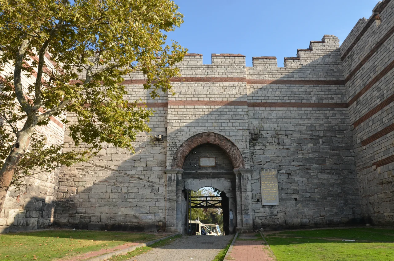

Edirnekapı, Fatih
On the morning of May 29, 1453, Sultan Mehmed II rode through a gate in the walls of Constantinople and into a city that had been the capital of the Eastern Roman Empire for eleven hundred years. The gate was called the Gate of Charisius by the Byzantines; it would later be called Edirnekapı by the Ottomans, the Gate of Edirne, for the old road to Adrianople that passed through it. The hill it stands on is the highest point of the walled city, and the view from here — across rooftops, minarets, the glint of the Golden Horn below — is the view Mehmed would have had as he surveyed what he had won. More than five centuries later, the gate still stands, and the neighborhood around it still carries the weight of that moment.
The Highest of Seven Hills
Istanbul is famously a city of seven hills, a topography that the Byzantines arranged their monuments around and that the Ottomans inherited. Edirnekapı occupies the sixth hill, which is the highest point within the old walled city — higher than the hill of the Süleymaniye, higher than the hill of the Fatih Mosque, high enough that the Walls of Constantinople here were among the most strategically significant in the entire circuit. The neighborhood corresponds to the Byzantine quarter of Deuteron, and it lies close to where the Blachernae section of the walls meets the older Theodosian walls — a junction point that was a critical defensive vulnerability. When the Ottoman assault came in 1453, the Blachernae area saw some of the most intense fighting. The gate through which Mehmed entered was near this contested ground.
A Gate With Many Names
The name Edirnekapı translates simply as Gate of Edirne. Edirne is the Turkish name for Adrianople, the ancient Thracian city that served as the Ottoman capital before Constantinople fell. The old Roman and Byzantine road to Adrianople passed through this gate, making it one of the principal western exits from the city. The Byzantines called it the Gate of Charisius, after a figure whose identity is no longer clearly known. Whichever name it carries, the gate has served the same function across the centuries: the point where the walled city opens toward Thrace, the place where armies arrived and ambassadors departed and merchants came and went with goods from the interior. The restored stonework of the gate is visible today, with the ancient towers flanking the opening in the walls that have stood since the fifth century.
Monuments on the High Ground
Edirnekapı is not only a gate; it is a neighborhood with its own layered history. The Chora Church — now the Kariye Museum after a complex sequence of conversions over the centuries — stands here, one of the finest surviving examples of Byzantine mosaic art in the world. Its fourteenth-century mosaics and frescoes depicting the life of Christ and the Virgin Mary are extraordinary achievements of late Byzantine art, preserved within walls that have been mosque and museum and, most recently, mosque again since 2020. The Mosque of Mihrimah Sultan also stands in Edirnekapı, commissioned by the daughter of Suleiman the Magnificent and designed by Mimar Sinan in the 1560s. The Edirnekapı Martyrs' Cemetery, one of Istanbul's oldest, lies outside the gate. The famous Islamic jurist Ibrahim al-Halabi is buried here.
The Greek Orthodox Church That Would Not Stay Down
Among Edirnekapı's places of worship, the Hagia Yorgi Greek Orthodox Church has a history of particular stubbornness. It was demolished once during the Byzantine Empire by order of Emperor Constantine V — who ruled in the eighth century and whose iconoclast policies made him a controversial figure — and rebuilt. It was demolished again to make way for the Mihrimah Sultan Mosque under the Ottomans in 1556. The church relocated to its present site and was rebuilt, then restored twice in the eighteenth century. In the nineteenth century it collapsed again entirely and was rebuilt once more. In 2014, a restoration project costing nearly four million Turkish lira was launched, and completed in 2017, reopening a church that has refused to disappear despite every pressure. It continues to serve Istanbul's small but enduring Greek Orthodox community.
A Neighborhood at the Edge of History
The district had a significant Orthodox Christian population for centuries, a community that departed for more central neighborhoods after 1955 — the year of Istanbul's September pogrom, during which Greek, Armenian, and Jewish properties across the city were attacked. The departure of that community left physical traces: churches, cemeteries, the memory of streets that once had a different sound. Today Edirnekapı is a working-class neighborhood, its main road, Fevzi Paşa Caddesi, one of the historic city's important arteries. Tourists come for the Chora mosaics and the view from the walls. But the gate itself, the worn stone threshold where an empire ended and another began, is simply part of the neighborhood — older than anything around it, part of the daily geography of people who may or may not pause to think about what passed through here on a May morning more than five hundred years ago.
From the Air
Edirnekapı sits at 41.0302°N, 28.9354°E on the sixth and highest hill of the walled city of Istanbul, on the European side. Flying into Istanbul Airport (LTFM, approximately 25 km to the northwest), the ancient Theodosian Walls are one of the most distinctive features visible on the European side — a long, double line of fortifications cutting across the western edge of the historic peninsula from the Sea of Marmara in the south to the Golden Horn in the north. At 2,000–3,000 feet on approach from the west, the walls' towers are individually visible in clear weather. Edirnekapı sits near the northern end of the Theodosian Walls, close to where they meet the Blachernae walls. The Chora Church dome is a useful landmark roughly 500 meters east of the gate.
Nearby Stories
- Kocaeli Peninsula 7.6 km away
- Second Battle of Çatalca 11 km away
- Istanbul's Rural Outskirts 14 km away
- MV Struma 20 km away
- HMAS AE2 36 km away
- Bursa 66 km away
- Sangarius Bridge 71 km away
- Januarius MacGahan 101 km away