
Erfurt
The money came out of a weed. For a long stretch of the Middle Ages, Erfurt's fortune rested on woad - Isatis tinctoria, an unremarkable yellow-flowered plant whose leaves, crushed, rolled into balls and left to ferment, yielded the only dependable blue dye in northern Europe. Everything the visitor now comes for was paid for by it: the merchant houses, the church towers, the university, the bridge lined with shops. Erfurt sat at the crossroads of the Via Regia, belonged to the Hanseatic League, and grew large and confident enough that when the rest of Germany was flattened in the twentieth century, what survived here amounted to one of the best-preserved medieval city centres in the country.
The Blue That Paid for Everything
Woad was grown across the Thuringian basin and traded through a handful of towns - Erfurt alongside Gotha, Arnstadt, Langensalza and Tennstedt - and the trade made all of them wealthy. Erfurt made the most of it, because Erfurt had the roads. The Via Regia, the great east-west highway of the medieval empire, ran straight through, and the city stood on a route of the Camino de Santiago as well. Merchants arriving from four directions needed places to stay, eat, worship and be taxed, and the compact centre that resulted is still legible: narrow pedestrian lanes, small bridges over the branches of the Gera, the long open square of the Anger, and at the Fischmarkt a Roland statue standing in front of the House of the Red Ox, a stone assertion that this was a town with rights of its own.
Two Churches on One Hill
Nothing in Erfurt prepares you for the Domplatz. The square is enormous and mostly empty, and along its western edge the ground lifts into a terrace carrying two great churches side by side - the cathedral and the church of St. Severus - reached by a broad flight of stone steps that functions half the year as public seating. In the cathedral's tower hangs the Gloriosa, the largest free-swinging medieval bell in the world; it is rung rarely, and hearing it is a matter of timing and luck. Northwest of the square the ground rises again into the Petersberg Citadel, a star-shaped baroque fortress built between 1665 and 1726 and one of the largest and best-preserved town fortresses in central Europe. From its ramparts the whole medieval core lies below in one view.
The University That Died and Came Back
Erfurt founded its university in 1379, making it one of the oldest in Germany, and for a while it mattered enormously. A miner's son from Mansfeld enrolled here in 1501, took his degrees, and in 1505 walked into the Augustinian monastery on the other side of town. Martin Luther was ordained a priest in Erfurt Cathedral in 1507 and left for Wittenberg in 1511, by which point everything that would later blow the Western church apart was already in place in his head. The university itself did not fare so well. It closed in 1816 and stayed closed for 178 years. A new University of Erfurt opened in 1994, five years after the Wall came down, and claims the old tradition as its own.
The Oldest Layer
Parts of Erfurt's Old Synagogue date to around 1094, which makes it the oldest surviving synagogue building in Europe, and the history it belongs to runs through the whole city. The first congregation was destroyed in 1349, when slanderous rumours blamed local Jews for the plague then killing their neighbours. Another had formed by 1354, and thrived until the city council expelled it in 1453. A third community grew through the nineteenth century and numbered 1,290 people by 1932; almost none of them survived what followed, and the few who did left Germany. And yet Erfurt held the only Jewish congregation in all of East Germany, and it has been growing again since the Soviet Union collapsed. In 2023 UNESCO inscribed the synagogue, the mikveh and the Stone House as the Jewish-Medieval Heritage of Erfurt.
Bratwurst, Trams, and a Window in 1970
The everyday city is easy company. A little over 218,000 people live here, the centre is small enough to cross on foot, and the trams come every ten minutes when you would rather not. The Thüringer Bratwurst is an Erfurt original and is sold from stalls all over town, each one convinced it does it properly. In December the Christmas market fills the Domplatz beneath the two churches. And on 19 March 1970 the Erfurter Hof hotel by the station hosted the first meeting between the heads of government of the two Germanys since the country split - Willy Brandt of the West, Willi Stoph of the East. A crowd gathered outside chanting for Brandt to come to the window. He did, briefly, and gestured for quiet. The words are set into the building's facade now, facing the square.
From the Air
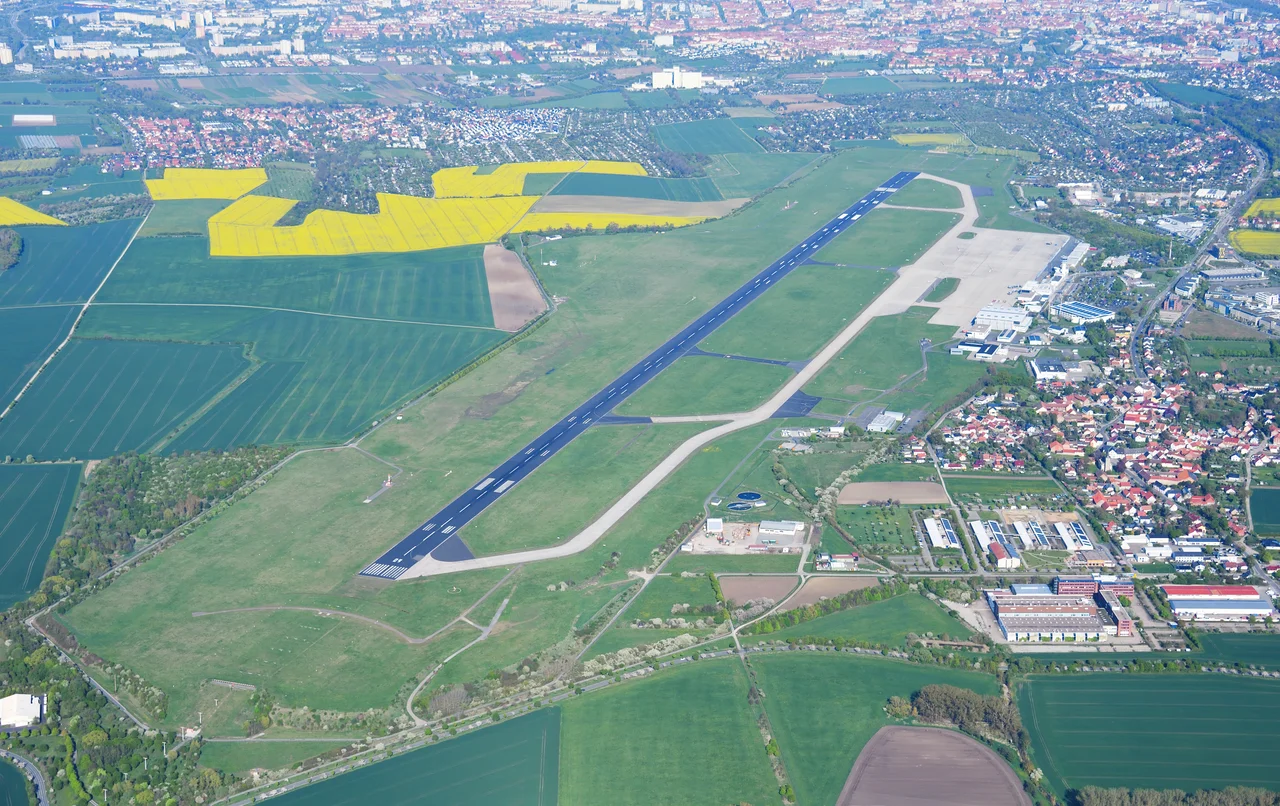
Erfurt lies at 50.978°N, 11.029°E, in the Thuringian basin. The visual fix from the air is the Domplatz group at the western edge of the old town - the cathedral and St. Severus standing together on their raised terrace - with the star-shaped bastions of the Petersberg Citadel immediately northwest, the most distinctive shape in the city and impossible to confuse with anything else. The Gera and its branches thread through the medieval core; the ridges of the Thuringian Forest run along the horizon roughly 30 km southwest. Best viewed at 1,500-3,000 ft AGL. Erfurt-Weimar Airport (EDDE) sits about 5 km west of the centre, so expect controlled airspace and local traffic; Leipzig/Halle (EDDP) is roughly 100 km northeast. Winter inversions in the basin can hold haze over the city well into the afternoon.
Nearby Stories
- Battle of Frankenhausen 3.6 km away
- Opfermoor Vogtei 13 km away
- Naumburg Cathedral 17 km away
- Saalfeld Fairy Grottoes 26 km away
- Francke Foundations 31 km away
- Unicorn Cave 36 km away
- Observation Post Alpha 44 km away
- Horch 62 km away