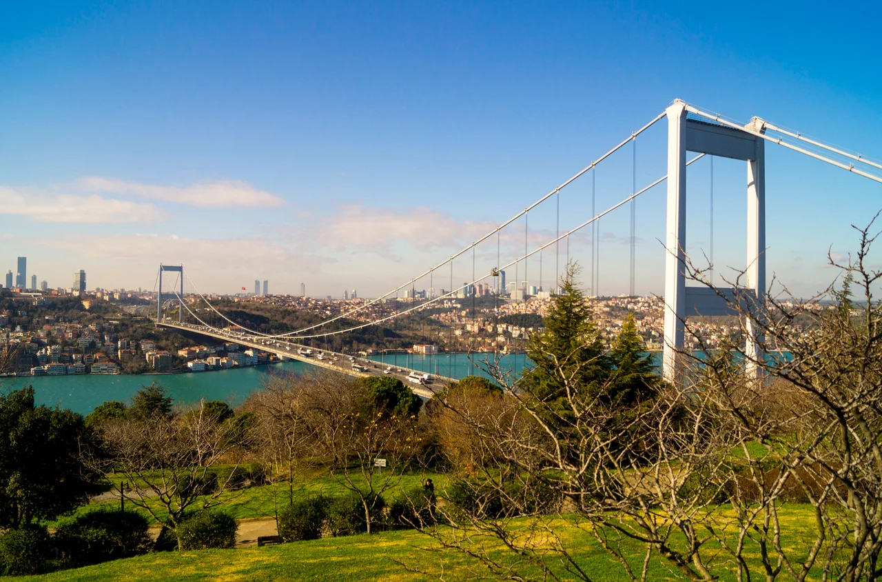

Fatih Sultan Mehmet Bridge
On 3 July 1988, Turkish Prime Minister Turgut Özal drove his official car across a bridge that had not existed six years earlier, becoming the first person to cross the Bosphorus on a span of steel 1,510 meters long. He was also, by some measure, crossing a threshold between continents — the same water that divided Europe from Asia, the same strait that Mehmed the Conqueror had gazed across in 1453 before taking Constantinople. The bridge was named for that sultan, and the naming was deliberate: the Fatih Sultan Mehmet Bridge, the second suspension bridge over the Bosphorus, joined a piece of modern infrastructure to a half-millennium of imperial memory.
Engineering a Crossing
The bridge is a gravity-anchored suspension bridge with steel pylons and vertical hangers, its aerodynamic deck hung on double vertical steel cables. The main span — the distance between the towers — stretches 1,090 meters, and the towers themselves rise 105 meters above the road deck. From the water below, clearance reaches 64 meters, enough for most large vessels navigating between the Black Sea and the Sea of Marmara. The deck is 39 meters wide, carrying multiple lanes of traffic in each direction. When it opened in 1988, it ranked as the fifth-longest suspension bridge span in the world. An international consortium built it: three Japanese firms including IHI Corporation and Mitsubishi Heavy Industries, one Italian company (Impregilo), and the Turkish firm STFA. The engineering firm Freeman Fox and Partners, which had also designed the first Bosphorus bridge, provided the structural design alongside BOTEK Bosphorus Technical Consulting.
Two Shores, One Name
The bridge links Hisarüstü on the European shore to Kavacık on the Asian side — two residential neighborhoods that were, before 1988, simply opposite banks of a very old sea lane. The strait it crosses has been contested, sailed, fished, and fought over for thousands of years. Persian armies crossed on pontoon bridges in antiquity. Byzantine and Ottoman fleets battled here for control of the waterway. Now trucks hauling goods from Bulgaria to Iran, and commuters in rush-hour traffic, cross it daily. The bridge carries the European route E80, Asian Highway 1, and Asian Highway 5 — designations that underscore the sheer geographic ambition of what this span achieves. Getting from one shore to the other used to require a ferry. Now it requires patience in traffic.
The Conqueror's Shadow
Istanbul now has four road crossings over the Bosphorus — the 15 July Martyrs Bridge (the original, opened in 1973), the Fatih Sultan Mehmet Bridge, the Yavuz Sultan Selim Bridge to the north, and the 1915 Çanakkale Bridge further west in the Dardanelles. Each carries the name of an Ottoman sultan or a pivotal date in Turkish history, a deliberate threading of national identity through infrastructure. Mehmed the Conqueror, for whom this bridge is named, took Constantinople on 29 May 1453. The bridge was completed on 29 May 1988 — the 535th anniversary of the conquest — a coincidence that, if not entirely coincidental, speaks to how deeply that date reverberates in Turkish consciousness. The bridge opened officially on 3 July.
From Above, the Strait
Seen from the air, the Bosphorus reveals its true character: a narrow, winding channel cutting diagonally through a sprawling megacity, its shores dense with neighborhoods that tumble down to wooden docks and ferry landings. The Fatih Sultan Mehmet Bridge appears from altitude as a slender thread connecting two densely built hillsides, the water beneath it glinting or churning depending on the weather. Tankers queue in the Black Sea waiting their turn to transit south. Fishing boats work the eddies below the bridge towers. The city spreads in every direction without apparent edge. For a pilot approaching from the north, the bridge is a reliable orientation point: find the second crossing, and you have your position over one of the world's great cities.
From the Air
The Fatih Sultan Mehmet Bridge lies at approximately 41.0911°N, 29.0614°E, spanning the Bosphorus between Hisarüstü (European side) and Kavacık (Asian side). It is unmistakable from the air: the second suspension bridge north of the 15 July Martyrs Bridge, with towers 105 m above road level. Recommend viewing altitude 2,000–4,000 feet for best detail of the cable and tower structure. Nearest airport: LTFM (Istanbul Airport), approximately 25 km northwest. The bridge is a key navigational landmark for VFR flight over Istanbul — positively identify it to distinguish from the nearby Bosphorus Bridge to the south.
Nearby Stories
- Kocaeli Peninsula 7.6 km away
- Second Battle of Çatalca 11 km away
- Istanbul's Rural Outskirts 14 km away
- MV Struma 20 km away
- HMAS AE2 36 km away
- Bursa 66 km away
- Sangarius Bridge 71 km away
- Januarius MacGahan 101 km away