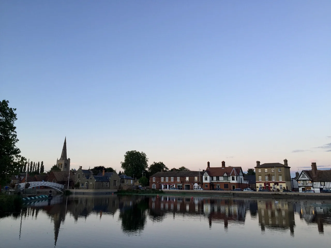

Godmanchester
Locals used to call it Gumster - and a stubborn few still do. The pronunciation has officially shifted to GOD-man-chester over the past century, but the older sound carries the ghost of how this town has actually been spoken about for nine hundred years. The Domesday Book of 1086 wrote it Godmundcestre, and the scribes who followed gave it a wandering spelling that would shame a modern auto-correct: Gutmuncetre, Gormancestre, Gurminchestre, Gummecestre, on and on, like a chorus losing the tune. Beneath all those spellings sits the same place: a riverside town one mile south of Huntingdon, separated by the floodplain of the Great Ouse, occupied without interruption for more than two thousand years.
A Temple to the Rising Sun
The headline find sits buried under what is now a gravel quarry on the town's edge. A neolithic temple of 6.3 hectares, carbon-dated to between 3685 and 3365 BCE, aligned precisely to catch the sunrise of Beltane - the Celtic May festival. Archaeologists have called it one of ancient Europe's most sophisticated astronomical sites, and the gravel beds that drew its builders to this exact bend of the river are the same gravel beds being scraped away by industrial extraction today. The river was the reason then and the reason later. The shallows here made a ford, and where you can ford a river you build a town - and eventually you build a Roman one called Durovigutum, sitting at the intersection of Ermine Street, the Via Devana, and a military road striking out toward Sandy. At its peak this crossroads town housed perhaps 3,000 people. A mansio - a Roman inn - stood here that is among the largest ever found in Britain. Then the third century brought Saxon raids, and the town shrank back into the meadows.
Charters, Crowns, and Cromwells
King John, who would soon be forced into Magna Carta, granted Godmanchester its first town charter in 1212. King James I granted a second one in 1604. By the time Sir Oliver Cromwell - uncle to the future Lord Protector and once one of the great hosts of James I at nearby Hinchingbrooke - lived out his days here, the town had two royal charters and a habit of hosting kings. Today over 100 listed buildings line its conservation areas, including Tudor Farm, the largest of them, built in 1600 and restored in 1995. The medieval Church of St Mary the Virgin, Grade I listed and 13th-century in its bones, sports a tower added in 1623 and a hymn tune named after the parish, composed by a vicar and aired on BBC's Songs of Praise in 2003.
The Bridge Made of Stories
Ask anyone in Godmanchester about the Chinese Bridge and you will likely hear that it was built without a single nail. It is a beautiful claim. It is also untrue - though gloriously persistent. The same myth surrounds the Mathematical Bridge at Queens' College, Cambridge, twenty miles south, and probably for the same reason: the original iron fixings in both bridges corroded over the centuries until they vanished into the timber, leaving the surface looking miraculous. The current Chinese Bridge is a 2010 replica, lifted out by crane on 9 February and replaced over two days the next week, and the new one openly uses nails. The bridge connects the town to a water meadow that has been crossed in various forms for centuries, sitting beside Portholme - England's largest meadow, an essential floodplain that has also served as a racecourse and, briefly in the early 20th century, an aviation field.
The Town the Motorways Pass By
The story of Godmanchester since the Romans has been the story of the road. Ermine Street, the great London-to-York artery, ran straight through here, and the town's prosperity rose and fell with traffic. In 2019 the six-lane A14 opened with a half-mile viaduct vaulting over the Great Ouse just south of town - the latest layer in a sequence of names (A1307, A604, A132, Via Devana) for what is essentially the same road the Romans drove. The town today has about 6,800 residents in 3,100 homes, with planning permission for 8,600 by 2036. Trains from Huntingdon reach London King's Cross in just over an hour. The town twins with Wertheim am Main, Salon-de-Provence, Szentendre and Gubbio - four European partners chosen, characteristically, from four different countries. Still on the river, still beside the meadow, Godmanchester continues. Even the spelling has finally settled down.
From the Air
Godmanchester sits at 52.3176N, 0.1725W, immediately south of Huntingdon and split from it by the Great Ouse floodplain. From the air, the town is most identifiable by its medieval bridge to Huntingdon, the broad green of Portholme meadow on the west, and the sweeping A14 viaduct south. Best viewed at 1,500-3,000 ft AGL. Nearest airfields: RAF Wyton (EGUY) three miles north-east, Conington (EGSF) nine miles north, Cambridge Airport (EGSC) about 18 miles south-east. The East Coast Main Line skirts the western edge of the town.
Nearby Stories
- Red Bull Racing 1.3 km away
- Flag Fen 2 km away
- Denver Windmill 3.1 km away
- Uppingham School 3.6 km away
- Sywell Aviation Museum 5.8 km away
- Newmarket, Suffolk 6.8 km away
- Letchworth 6.9 km away
- Castle Hedingham 18 km away