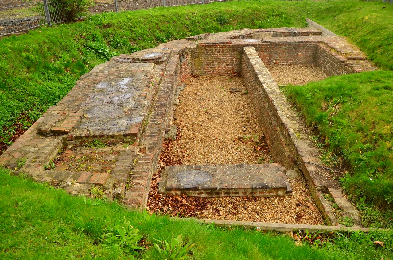

Gravesend Blockhouse
Henry VIII broke with Rome in 1533, and the bill came due six years later. France and the Holy Roman Empire had signed an alliance against him. The Pope was urging both Catholic powers to attack. England's coastal defences were a patchwork of local towers and crumbling walls that the Crown had largely left to local lords. In the spring of 1539, the king issued a sweeping order, called a 'device', for the defence of the realm in time of invasion. Among the dozens of forts that rose along the English coast that year, a squat, D-shaped brick building took shape on the south bank of the Thames at Gravesend - the place where, by everyone's calculation, an invading army would first be able to step ashore on its march to London.
Why Here, Why Now
Eighty percent of England's exports moved through the Thames estuary. The new royal dockyards at Deptford and Woolwich, the warehouses of the City, and ultimately Westminster itself all lay upriver from this narrow neck of water. Below Gravesend, mudflats and shoaling channels made landings difficult; above it, the river funneled inward toward the capital. The village of Milton and the adjacent town of Gravesend sat barely 500 metres apart on a riverbank already crowded with wharves, busy with the Long Ferry that carried passengers to London and the Cross Ferry that ran to Tilbury on the Essex shore. Whoever held this stretch held the door to the kingdom. Henry built that door in brick.
The Builders and the Bill
The Clerk of the King's Works, James Nedeham, and the Master of Ordnance, Christopher Morice, drew up the plans. Robert Lorde kept the books. Local men - Lionel Martin, John Ganyn, a Mr Travers - watched the work go up. The Crown bought the land from a William Burston for sixty-six pounds. Earlier estimates had set the construction cost at around two hundred and eleven pounds, calling for 150,000 bricks and quantities of stone, chalk, lime, and timber. The walls rose two metres thick, brick faced with smooth ashlar stone. A circular bastion bulged out over the river, gun platforms stretched east and west along the bank, and by 1540 the blockhouse was operational. Captain James Crane took command of a garrison of ten - a porter, six gunners, two soldiers, and Crane's second. The one obvious flaw was behind them: higher ground overlooked the rear, and the fort would have been hard to defend from a landward attack.
Armada and Boom
The invasion Henry feared never came in his lifetime. By 1553 the artillery was ordered up to the Tower of London, though the historian Victor Smith doubts the order was carried out. Then, in 1588, the Spanish came. The Armada sailed from A Coruna while a separate force gathered in Flanders, poised to cross the Channel and march on London. Robert Dudley, Earl of Leicester, was put in charge of the Thames defences. Plans were drawn up to seal the river entirely with a chain or floating boom stretched from Gravesend to Tilbury Fort opposite - a wooden cable across the Thames itself, eventually completed at a cost of three hundred and five pounds. Earthworks rose. Watch-houses went up. The Armada was scattered by storms and English fireships before any of it was tested in earnest.
Civil War, Restoration, and a Royal Banqueting Hall
The seventeenth century was harder on Gravesend Blockhouse than on most. James I and Charles I let the fort decline; by 1630 the garrison's pay was in arrears and repairs were estimated at over twelve hundred pounds. When civil war broke out in 1642, Parliament took the river, installing a military governor who used the blockhouse to search Thames traffic for spies bound for the royalist camp. After Charles II returned in 1660, William Leonard won the command back for the king's men, and Charles is said to have occasionally used the building as a banqueting hall on river journeys. The fort itself was, by then, not really a fort anymore - it had become a magazine, capable of holding 2,500 barrels of gunpowder. When the Dutch raided the Thames in 1667 and burned the English fleet at Chatham just upstream, the blockhouse's guns watched the smoke rise.
Outgunned by Geometry
By the late eighteenth century the problem was no longer politics but ballistics. Sir Thomas Page surveyed the blockhouse in 1778 and concluded the guns were too tightly packed and angled badly to fire downriver. His solution was not to renovate but to build alongside. The much larger New Tavern Fort rose immediately to the east, and the blockhouse's old eastern platform was redesigned and rolled into the new works. In 1805 the blockhouse still mounted nineteen 32-pounders, but its days were numbered. By the 1830s the government decided to commit fully to New Tavern and Tilbury, and in 1844 the old blockhouse was demolished after three centuries of standing watch.
Found Again
Where the building once stood is now the garden of the Clarendon Royal Hotel, on the Gravesend riverbank. Kent Archaeological Society dug there in 1975 and 1976 and found the foundations - the curve of the bastion, the line of the river-facing wall, the bricks Captain Crane's gunners walked over for years. The site was protected as a scheduled monument in 1979. The Thames still slides past where the boom was meant to stretch, and Tilbury Fort stands plainly on the far bank, but the blockhouse that started it all is now a low pattern of brick under English grass.
From the Air
Coordinates 51.4446 N, 0.3728 E, on the south bank of the Thames at Gravesend, Kent. The site sits in the grounds of the Clarendon Royal Hotel just east of Gravesend town pier. From the air, look for the bend in the Thames where the river narrows after the open estuary, with Tilbury Fort directly opposite on the Essex shore. Recommended viewing altitude 2,000-3,000 feet for context of the river network. Nearest airports: London City (EGLC) 19 nm west, London Southend (EGMC) 12 nm northeast, Rochester (EGTO) 8 nm southeast.
Nearby Stories
- Waltham Abbey Royal Gunpowder Mills 1.6 km away
- Bethlem Royal Hospital 4.4 km away
- Sissinghurst Castle Garden 5.6 km away
- Chelmsford 6.5 km away
- Herne Bay Pier 6.7 km away
- Operation Stack 7.1 km away
- St Osyth's Priory 13 km away
- Plymouth Brethren 24 km away