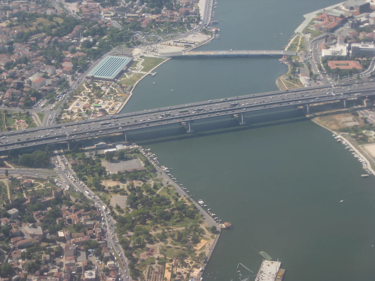

Haliç Bridge
The Golden Horn is one of the great natural harbors of the world, a curving inlet that has shaped Istanbul's geography for three thousand years. Byzantine emperors once stretched a chain across its mouth to block enemy fleets. Ottomans dragged their ships overland to bypass it. In the early 1970s, engineers from Japan and Germany solved a more prosaic but equally significant challenge: how to carry Istanbul's growing motorway traffic across this storied water. The Haliç Bridge, completed in 1974, was their answer.
Where Neighborhoods Meet Water
The bridge connects two districts that face each other across the upper end of the Golden Horn. To the southwest is Ayvansaray, part of the historic peninsula, where Byzantine land walls still stand and some of the city's oldest neighborhoods slope down to the water. Across the span to the northwest is Halıcıoğlu, in the Beyoğlu district, a mixed residential and industrial area that has been home to various communities over the centuries. Before the bridge existed, crossing here meant navigating the city's streets to reach one of the lower crossings near the Bosphorus. The Haliç Bridge shortened that journey considerably. It carries the O-1 motorway — the Istanbul Inner Beltway — a major ring road that defines the boundary between the historic core and the expanding modern city.
Engineering Across Continents
The bridge was constructed between 1971 and 1974, a joint project between IHI Corporation of Japan and Julius Berger-Bauboag AG of Germany. It was a postwar international collaboration typical of major infrastructure projects of the era, when engineering firms from different countries pooled expertise on large civil works. The bridge entered service on September 10, 1974. At 995 meters in length and 32 meters in width, it is a substantial structure. It stands 22 meters above sea level, providing clearance for the vessel traffic that has used the Golden Horn for commerce and transport since antiquity. The numbers are precise but also evocative: just under a kilometer long, high enough for maritime traffic, wide enough to carry the lanes of a major urban motorway.
The Golden Horn It Crosses
To understand the Haliç Bridge, you need to understand the water it spans. Haliç is the Turkish name for the Golden Horn — an estuary, roughly 7.5 kilometers long, that flows into the Bosphorus at Istanbul's northwestern corner. Byzantine Constantinople used it as a protected harbor; the chain across its mouth is one of the defining images of medieval naval history. Ottoman Istanbul built shipyards along its shores. In the twentieth century, the Golden Horn became heavily industrialized and polluted before a major cleanup campaign beginning in the 1980s restored much of its water quality. The bridge sits near the upper end of this inlet, where the waterway narrows and the two banks close in. From the bridge deck, looking south toward the Bosphorus, you see the full sweep of the Golden Horn with the historic peninsula rising on the right and Beyoğlu on the left.
A Bridge Among Bridges
Istanbul is a city of bridge crossings. The Galata Bridge, at the mouth of the Golden Horn, is the most famous and the most photographed, lined with fishermen at all hours. The Atatürk Bridge, nearby, carries older memories of the pre-highway city. The Golden Horn Metro Bridge, a more recent addition, carries rail passengers across the water to the northwest. The Haliç Bridge belongs to this family but plays a utilitarian role: it is a motorway bridge, functional and purposeful, carrying the daily flow of vehicles that keep a metropolis of fifteen million people moving. It lacks the pedestrian drama of the Galata Bridge. What it offers instead is the view: the Golden Horn spread below, the minarets of the historic peninsula to the south, and on clear days the Princes' Islands visible in the distant Marmara.
The Golden Horn from Altitude
Few bodies of water are as legible from the air as the Golden Horn. Its distinctive curving shape — narrowing as it runs northwest from the Bosphorus — is an immediate identifier for anyone approaching Istanbul from the north or west. The Haliç Bridge is visible near the upper third of that curve, the bridge deck a thin line between the two banks. Below the bridge, the water reflects whatever sky Istanbul is offering that day. Istanbul Airport, LTFM, lies approximately 25 kilometers to the northwest; aircraft on approach from the west often track southward above the European districts, crossing the upper Golden Horn at moderate altitude before turning toward the historic peninsula.
From the Air
The Haliç Bridge crosses the Golden Horn at 41.044°N, 28.942°E, near the upper end of the inlet where it narrows between the Ayvansaray and Halıcıoğlu neighborhoods. The bridge is easily identifiable from the air by the characteristic curve of the Golden Horn below it. Best viewed at 1,500–3,000 ft on approach from the northwest. Nearest major airport: Istanbul Airport, LTFM, approximately 25 km northwest.
Nearby Stories
- Kocaeli Peninsula 7.6 km away
- Second Battle of Çatalca 11 km away
- Istanbul's Rural Outskirts 14 km away
- MV Struma 20 km away
- HMAS AE2 36 km away
- Bursa 66 km away
- Sangarius Bridge 71 km away
- Januarius MacGahan 101 km away