
Harbour of Eleutherios
In November 2005, construction workers boring a tunnel beneath the Yenikapı neighborhood of Istanbul struck something unexpected: the silted-up ghost of a harbour that had swallowed centuries. The Marmaray rail project — a modern feat linking Istanbul's European and Asian shores under the Bosphorus — had punched straight into the Portus Theodosiacus, the great Byzantine harbour whose location scholars had long debated. What followed was one of the most remarkable archaeological excavations in urban history, halting a billion-dollar infrastructure project for years and rewriting what we know about the city that would become Constantinople.
The Harbour That Fed an Empire
Built in the late 4th century during the reign of Emperor Theodosius I, the harbour that bore his name was Constantinople's commercial heart. It sat on the southern shore of the city's peninsula, where the Lycus watercourse met the Sea of Marmara — a natural funnel for trade. Grain, timber, olive oil, wine: everything that sustained a capital of half a million people moved through these docks. The harbour served the city for roughly seven centuries, from Late Antiquity through the early Byzantine period, before gradually silting shut. By Ottoman times, the sea had retreated and buildings rose over the old waterline. The harbour disappeared so completely that even its precise location was uncertain — historians knew it existed, but the mud of the Marmara had erased every surface trace.
Ships That Never Sailed Again
When archaeologists got to work after the 2005 discovery, the scale of what lay beneath Yenikapı became staggering. Excavations uncovered the remains of 37 Byzantine ships, dating from the 5th to the 11th centuries. Among them were several Byzantine galleys — oared warships whose physical remains had never previously been found anywhere in the world. The mud that silted the harbour had done what no museum could: preserved wood, rope, rigging, and cargo in extraordinary detail. Some hulls still held their last loads. Amphorae that once carried olive oil or wine sat exactly where they had been stowed. The ships tell a story of storm as much as of commerce: many appear to have been driven onto the harbour's shallows during severe weather and abandoned there, their owners presumably moving on while the vessels slowly became part of the seabed.
Eight Thousand Years Beneath the City
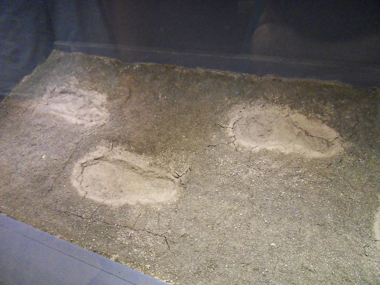
The ships were extraordinary. What lay beneath them was even more so. Archaeologists working deeper into the sediment found artifacts that pushed the site's human history far earlier than anyone had imagined — pottery fragments, shells, animal bones, and nine human skulls discovered together in a bag. Radiocarbon dating placed the oldest objects at around 6000 BC, making Yenikapı the site of the oldest known human settlement on the land that would become Constantinople. For a city that likes to count its history in mere millennia, this was a revelation. The footprints of Neolithic inhabitants were found preserved in the ancient shore mud — not metaphorical footprints, but actual impressions left by human feet walking on a beach eight thousand years ago, then sealed by successive layers of silt and time.
The Archaeology of Interruption
The Yenikapı excavation ran from 2005 to 2013, making it one of the longest-running rescue excavations in Turkish history. "Rescue archaeology" is the formal term: work conducted under the pressure of a construction deadline, against the clock and the budget of a major infrastructure project. The Marmaray tunnel eventually opened in 2013, but only after the excavation teams had documented thousands of artifacts and removed the ship remains for conservation. The finds are now housed in the Istanbul Archaeological Museums. What they reveal is a layered city — Byzantine merchant quarter above Neolithic shore, Roman infrastructure above Byzantine harbour mud — compressed into a few meters of earth beneath a neighborhood where people today buy groceries and catch ferries. The harbour's modern name, Yenikapı (New Gate), refers to an Ottoman city gate. The ancient port that gave the neighborhood its significance is invisible from the street, but it is there.
A Name Still Debated
The Wikipedia article title names this the Harbour of Eleutherios, but that identification remains unresolved. Ancient sources mention both the Harbour of Eleutherios and the Harbour of Theodosius in the same general area of Constantinople's southern coast, and scholars continue to debate whether they were the same harbour, adjacent harbours, or the same harbour known by different names at different periods. The Portus Theodosiacus — the Theodosian Port — is the name confirmed by the 2005–2013 excavations. The Harbour of Eleutherios may still await discovery, or it may already have been found. In a city where archaeologists routinely find Byzantine palaces beneath hotel foundations and Neolithic villages beneath train stations, the possibility seems entirely reasonable.
From the Air
The Harbour of Eleutherios / Yenikapı excavation site lies at 41.0047°N, 28.9522°E on the European (Thracian) shore of Istanbul, at sea level along the Sea of Marmara. Approaching from Istanbul Havalimanı (LTFM, approximately 35 km to the northwest), the site is visible as the Yenikapı district along the Marmara shoreline, just west of the historic peninsula where Hagia Sophia and the old city walls are clearly identifiable. At 2,000–3,000 feet, the outline of the old Byzantine harbour zone and the modern Marmaray rail infrastructure are both visible. Best approached from the south over the Marmara, with the Sea of Marmara to your left and the peninsula's western end ahead.
Nearby Stories
- Kocaeli Peninsula 7.6 km away
- Second Battle of Çatalca 11 km away
- Istanbul's Rural Outskirts 14 km away
- MV Struma 20 km away
- HMAS AE2 36 km away
- Bursa 66 km away
- Sangarius Bridge 71 km away
- Januarius MacGahan 101 km away