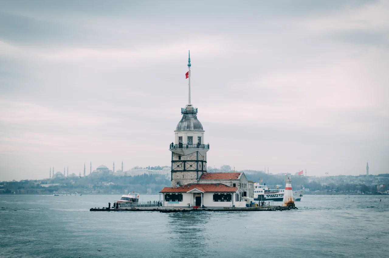

Istanbul/Asian Bosphorus
Cross the Bosphorus by ferry and the city changes texture. The European side moves faster, louder, more relentlessly commercial. The Asian shore exhales. Üsküdar's waterfront opens up, the mosque minarets are reflected in the strait, and somewhere nearby a group of morning swimmers — the self-styled Sarayburnu Fatihleri, the Seraglio Conquerors — are doing what they do every day: swimming across one of the world's busiest shipping channels purely because the law doesn't forbid it. Istanbul's Asian Bosphorus is the half of the city most visitors overlook, and the half that rewards those who don't.
Chrysopolis to Üsküdar
The Greeks called it Chrysopolis — the Golden City. Long before Istanbul existed, this spot on the Asian shore was already significant: a landing point for travelers crossing from Europe into Asia. Under the Ottomans it became Üsküdar, sometimes called Scutari in Western sources, and it carries that deep history visibly — in its mosques, its cemetery hills, its busy ferry docks. Today Üsküdar is one of Istanbul's most atmospheric districts: unhurried by the standards of this city, its waterfront cafes and markets operating at a pace that feels genuinely distinct from the European side.
North along the strait lies Beykoz. Known in antiquity as Amikos and later a favored retreat for Ottoman elites, Beykoz remains one of the greenest parts of Istanbul — a district of yalıs (traditional waterfront mansions), forested hillsides, and coastline that feels almost rural in places. The two districts bracket the Asian Bosphorus, one at its southern gateway and one at its northern reaches, each with its own character.
Getting Across
Istanbul has three bridges across the Bosphorus — the Bosphorus Bridge (O-1), the Fatih Sultan Mehmet Bridge (O-4), and the Yavuz Sultan Selim Bridge (O-7) — and every one of them is congested for most of the day. Rush hour on the bridges runs 07:00 to 10:00 heading west into Europe and 18:00 to 20:00 coming east into Asia. Cross-Bosphorus buses require two tickets rather than one.
The sensible alternative is the ferry. Ferries run frequently between Üsküdar and Eminönü, Üsküdar and Beşiktaş, and Beykoz and Sarıyer, with multi-stop lines along the strait as well. The crossing takes minutes, costs almost nothing, and delivers you to the Asian shore with the city's skyline behind you and the Golden Horn opening up to the north. There is also the Metrobüs — a bus rapid transit line with its own dedicated lane — which connects the European suburbs to Söğütlüçeşme near Kadıköy, just south of the Asian Bosphorus district. High-speed trains from Ankara and eastern Turkey also terminate at Söğütlüçeşme.
Along the Water
The causeway (sahilyolu) runs the full length of the Asian Bosphorus, with marked bicycle lanes that make it possible to ride from one end to the other — though the instruction to "watch out for pedestrians" is well-meant and worth heeding. Cafes line the Salacak Coast in Üsküdar; the neighborhood of Kuzguncuk, a little north, is known for its quiet streets and old wooden houses. Çengelköy's Tarihi Çınaraltı cafe, under its ancient plane tree, is the kind of institution that locals guard carefully from too much attention.
Food along the waterfront runs toward fish. Balık ekmek — a grilled fish fillet inside half a bread roll, sold from waterfront buffets — is the definitive Bosphorus lunch. Mussel sandwiches with garlic sauce, kokoreç, patso: the Asian shore has its own street food grammar. For dinner, restaurants along Kuleli Street in Çengelköy offer splurge-level meals with Bosphorus views that justify the prices. The drink of the strait is salep, a warm beverage made from orchid flour, found in almost every cafe during the cooler months.
The Specialty of the Bosphorus
Istanbul is a coffee city now — the chains are present on the Asian shore as everywhere else — but the drink the Bosphorus invented is salep: a warm, thick beverage made from dried orchid tubers, spiced with cinnamon, without a precise equivalent anywhere else. Municipality-run Beltur cafes in Çamlıca, Nakkaştepe, and Beykoz serve it; so do the waterfront cafes that face the strait.
For a longer evening, Beylerbeyi is the center of the Asian Bosphorus meyhane culture — the traditional tavern where raki and meze constitute an entire meal and a night's entertainment. Established options include Inciraltı, Villa Bosphorus, and Suppa. Those seeking more active nightlife generally head south to Kadıköy. The Asian Bosphorus runs quieter after dark, which is part of what makes it worth crossing to.
The Strait from the Air
The Bosphorus is one of the most dramatic geographic features visible from altitude anywhere in the world: a narrow channel, roughly 30 kilometers long and as little as 700 meters wide at its narrowest, threading between two continental landmasses and carrying a continuous stream of shipping between the Black Sea and the Sea of Marmara. From cruising altitude on a clear day, you can see all three bridges, the green hills of the Asian shore, and the dense European city across the water.
The Asian Bosphorus district centers around 41.026°N, 29.015°E. The nearest major airport for the Asian side is LTFJ (Sabiha Gökçen International Airport), approximately 30 kilometers southeast on the Asian shore — a significantly closer approach than Istanbul Airport (LTFM) on the European side. Descending toward LTFJ, the Bosphorus is visible to the northwest, with the forested hills of Beykoz and the white wake of ferries crossing the strait below.
From the Air
The Istanbul Asian Bosphorus district is centered at approximately 41.026°N, 29.015°E on the Asian shore of the Bosphorus, covering the districts of Üsküdar and Beykoz. The Bosphorus is unmistakable from altitude — a narrow channel separating two continents, with three bridges and heavy ship traffic visible in clear conditions. Nearest airport for the Asian side: LTFJ (Sabiha Gökçen International Airport), approximately 30 km southeast. Istanbul Airport (LTFM) on the European shore is approximately 50 km west. Recommended viewing altitude: 3,000–8,000 feet for a full view of the strait and both shorelines.
Nearby Stories
- Kocaeli Peninsula 7.6 km away
- Second Battle of Çatalca 11 km away
- Istanbul's Rural Outskirts 14 km away
- MV Struma 20 km away
- HMAS AE2 36 km away
- Bursa 66 km away
- Sangarius Bridge 71 km away
- Januarius MacGahan 101 km away