
Istanbul/Western Suburbs
Every long journey into Istanbul begins out here, in the western sprawl that most visitors simply pass through without a second glance. The airport is here. The great otogar, the main bus terminal funneling travelers in from Greece and Bulgaria and the whole of Thrace, sits out here too. So does the European mainline railway terminus — for the moment, at least. In a city obsessed with its own center, the Western Suburbs do the unglamorous work of keeping things moving, and in doing so accumulate a character all their own.
Gateway to a Continent
In 2005, Istanbul's administrative boundaries expanded to swallow Istanbul Province whole, pushing the city's official edge 50 kilometers west to the border with Tekirdağ Province. That decision transformed the Western Suburbs from peripheral neighborhoods into a vast urban region spanning European Thrace. The Marmara Sea coast along this stretch was once a string of seaside resorts — Yeşilköy, Bakırköy, Büyükçekmece — that the city has since grown around and absorbed. Now they function as commuter zones by weekday and local beach destinations by weekend, their harbors lined with fish restaurants and pleasure boats. Inland, the character shifts: residential blocks give way to quarry-scarred hills and surprisingly rural stretches, the last patches of agricultural land clinging on at the urban edge.
The Web of Lines
Getting around this district requires some navigation. Metro line M1 radiates from Aksaray downtown and fractures into branches, one heading west toward Kirazli and connecting with the M3 and M9 lines, the other curving south through Bakırköy to Zeytinburnu and Ataköy. Tram line T1 stitches these nodes together, running from Kirazli all the way through to Sirkeci in the old city. The Metrobüs — a hybrid articulated bus running in a dedicated lane along the D100 highway — slices east-west across the peninsula with impressive speed, though the crowds at peak hours are legendary. For local residents, the dolmuş minibuses running round the clock between Taksim and Bakırköy, Ataköy and Yeşilköy remain the connective tissue of daily life. Ferry piers along the Marmara shore add another dimension, linking the western coast to central and eastern Istanbul across the water.
Two Lagoons and a Coast
West of Yeşilköy, two lagoons indent the Marmara shoreline — the little one, Küçükçekmece, and the big one, Büyükçekmece. Birdwatchers know Lake Büyükçekmece well; it draws migrating species in numbers that surprise first-time visitors. The Black Sea coast along the northern edge of this region has developed more slowly than the Marmara shore, retaining small resorts and beaches within easier reach of open countryside. Above the village of Ormanlı, the cliffs above a Black Sea beach serve as a launch point for tandem paragliding, the kind of excursion that ends with an aerial view of the whole Thracian peninsula spread below. Forest trails in Çilingoz Nature Reserve offer something rarer still in Istanbul: genuine quiet.
History at the Margins
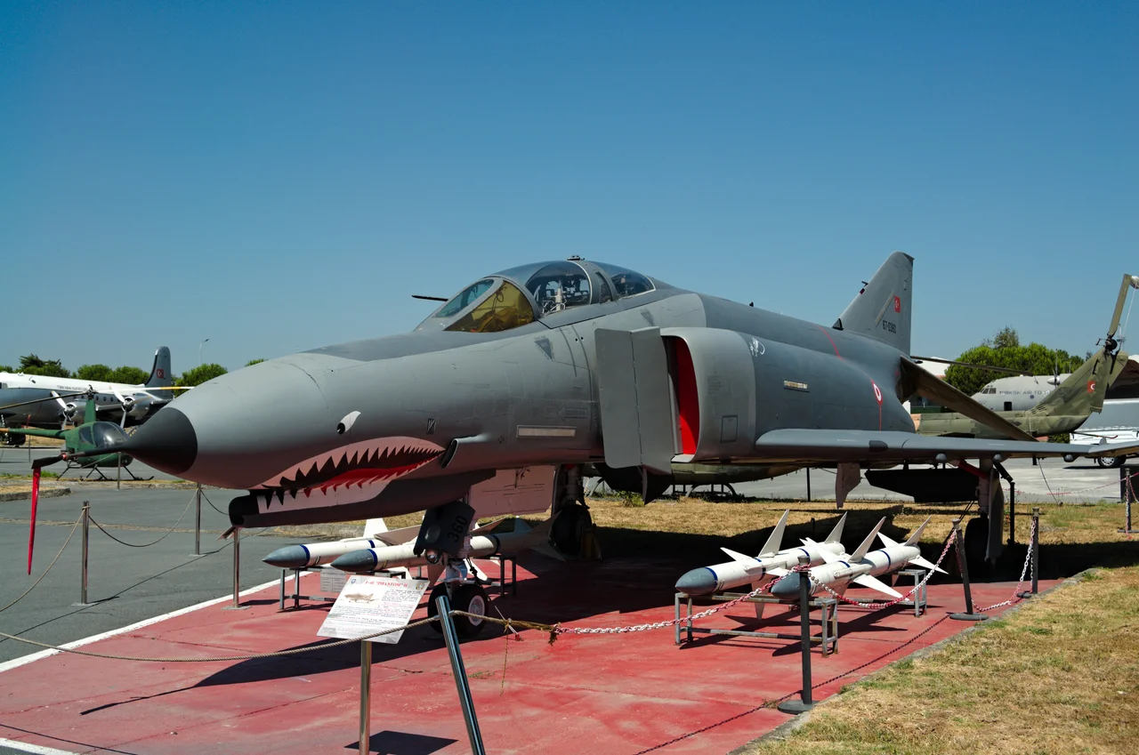
Yeşilköy carries one of the more significant pieces of Ottoman diplomatic history. It was here — then known as San Stefano — that the 1878 treaty ending the Russo-Turkish War was signed, a document that briefly created a large Bulgarian state before the great powers at Berlin revised its terms. A house in the village still marks the site. The suburb also shelters the Mor Ephrem Syriac Orthodox Church and other religious communities that found room outside the crowded old city. The Istanbul Aviation Museum, near the site of the old Atatürk Airport, preserves military aircraft including an F-4 Phantom. History settles unevenly in these outer neighborhoods, surfacing in unexpected places.
The Road Keeps Going
For the traveler continuing west from Istanbul, these suburbs are the departure gate. Long-distance buses fan out from the Esenler otogar toward Greece, Bulgaria, and every corner of Turkey. Regional routes push into Eastern Thrace — to Saray, Vize, and Kıyıköy on the Black Sea. Further west, Tekirdağ beckons with its meatballs and rakı, then Edirne with its magnificent Selimiye Mosque. The old Ottoman capital sits near the Bulgarian border, a reminder that Istanbul's gravitational pull extends far beyond its own sprawling edges. The Western Suburbs know this transit role intimately; they have always been the place where Istanbul begins to let go.
From the Air
Coordinates: 41.039°N, 28.855°E. Flying westbound out of Istanbul, the European sprawl unfolds beneath you — the pale strip of the Marmara coast running southwest, the two lagoons of Küçükçekmece and Büyükçekmece glinting like mirrors. Istanbul Airport (LTFM) lies roughly 35 km northwest of the city center in this outer zone, its enormous runway complex visible from altitude. At 3,000–5,000 feet, the old Atatürk Airport site near Yeşilköy is identifiable by its cleared ground south of the coast road. The D100 highway, a bold east-west slash across the peninsula, marks the route of the Metrobüs corridor.
Nearby Stories
- Kocaeli Peninsula 7.6 km away
- Second Battle of Çatalca 11 km away
- Istanbul's Rural Outskirts 14 km away
- MV Struma 20 km away
- HMAS AE2 36 km away
- Bursa 66 km away
- Sangarius Bridge 71 km away
- Januarius MacGahan 101 km away