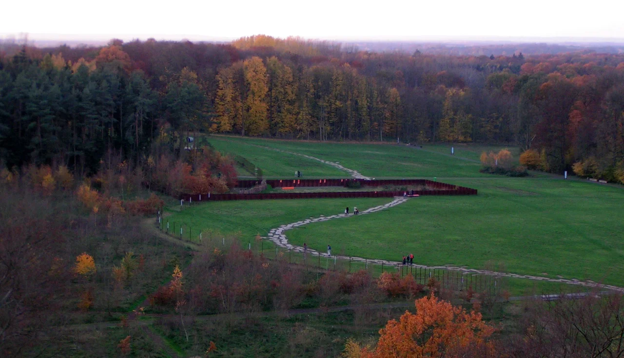

Kalkriese
In 1987 a British army major stationed in Osnabrück asked the local museum archaeologist where a man with a metal detector might reasonably dig. Wolfgang Schlüter pointed him toward farmland north of the city, near a village called Kalkriese, where an old scholarly hunch had never quite been tested. Tony Clunn worked the fields over a weekend and came up with eighty-nine Roman silver denarii. The following weekend brought the total to a hundred and five. Not one had been struck after the reign of Augustus. Then came the lead sling bullets - not the residue of trade or settlement, but the ammunition of an army in a fight. The longest-running missing-persons case in Roman history suddenly had an address.
A Village on the Wrong Side of the Hill
Kalkriese is administratively a piece of Bramsche, in the district of Osnabrück, and it sits on the northern slope of the Wiehen Hills, the ridge that runs east to west across this part of Lower Saxony. The hill above it, the Kalkrieser Berg - locals also call it the Schmittenhöhe - reaches only 157 metres. That is not much of a mountain. What matters is what lies immediately north of it: the Großes Moor, a bog wide enough that no army wants to walk into it.
Between the rising ground and the wet ground runs a strip of firm, cultivable land about 220 metres across. Anyone moving east or west through this landscape in antiquity had to use it, and using it meant crossing brook after brook, each one a chance to bunch up, slow down, and lose the line of march. The Romans called the region the saltus Teutoburgiensis. Modern archaeology just calls it the corridor.
Five and a Half Thousand Pieces of Rome
Official excavation began in 1988 and has not really stopped since. More than 5,500 Roman objects have come out of an area covering seventeen square kilometres: swords and daggers, the iron heads of javelins and spears, arrowheads, sling stones, fragments of helmets, belt fittings, hooks from chainmail shirts, scraps of body armour, and - in great quantity - the hobnails that studded the soles of Roman military boots. Hobnails are the archaeologist's favourite find here. They fall out when men run, fight and die, so they map movement rather than ownership.
Among the coins is one struck in 2 BC to mark Augustus's adoption of his grandsons Lucius and Gaius, an imperial family announcement that ended up in a German bog inside somebody's purse. In 2016 excavators turned up eight gold coins. And in the museum cases, staring straight back at whoever leans in, sits the silvered iron face of a cavalry helmet whose owner has no name.
The Argument in the Soil
None of this settles the question quite as neatly as the signage suggests. Kalkriese is the leading candidate for the clades Variana of 9 AD - the disaster in which Publius Quinctilius Varus lost three legions and their auxiliaries to an alliance led by Arminius, an officer of Varus's own auxiliary forces who held Roman citizenship and had received a Roman military education. The identification is strongly supported. It is not closed.
One long-running alternative holds that some of the debris belongs instead to the campaigns Germanicus fought east of the Rhine between 14 and 16 AD, when Roman armies came back to the region in force. A geoarchaeological study published in 2024 pushed harder still, arguing that the famous zigzag rampart along the corridor - long read as a Germanic fighting position built to funnel the Romans - is a considerably later feature, with the associated deposits dating to around 1000 AD. The coins remain stubbornly Augustan. Much of the rest is contested.
Reading a Field
What makes Kalkriese unusual among ancient sites is that it has been excavated as a battlefield rather than as a settlement. There are no walls to trace, no floor plans, no rubbish pits with a helpful pottery sequence. There is only scatter - the density and direction of small metal objects across ordinary farmland, read the way a ballistics analyst reads a room. That method was developed here as much as anywhere, and it is now standard practice in conflict archaeology worldwide.
The site is open to visitors, with a museum and an archaeological park laid across the corridor and a tower that lets you look down on it. From up there the ground is almost disappointing: hedges, fields, a road, the dark line of the moor to the north, the wooded hill to the south. It takes a real effort of imagination to put an army into it. That effort is more or less the point of the place.
From the Air
Kalkriese lies at 52.41 degrees N, 8.13 degrees E, roughly 15 km north of Osnabrück in Lower Saxony. From the air the site reads as a narrow band of cultivated ground pinned between the wooded Wiehen Hills ridge running east-west to the south and the darker, flatter wetland of the Großes Moor to the north - the corridor is easier to see from altitude than from the ground. The museum and its observation tower mark the centre of the excavated area. Nearest airport is Münster Osnabrück International (EDDG), about 45 km to the southwest; Bremen (EDDW) lies about 90 km northeast. Best viewing altitude 3,000-5,000 feet. The ridge line is a reliable visual anchor in haze; the moor darkens noticeably after rain.
Nearby Stories
- Else (Werre) 0.6 km away
- Münster Osnabrück Airport 8.7 km away
- Visbek 12 km away
- Battle of Idistaviso 16 km away
- Minden 21 km away
- Ibbenbüren 22 km away
- Börger 24 km away
- Schnoor 38 km away
Sources
- Kalkriese - Wikipedia
- Tony Clunn - Wikipedia
- Germanic Rampart or Roman Encampment? New Geoarchaeological Evidence at the Roman Conflict Site at Kalkriese - Geoarchaeology
- Acht Goldmünzen auf dem antiken Schlachtfeld in Kalkriese gefunden - University of Osnabrück
- Final review pass - independent web verification