
Kontoskalion
By around 1540, the French traveler Pierre Gilles reported that the women of the neighborhood were using the old harbor basin to wash their clothes. A century earlier, Emperor John VIII had employed paid workers — including clergymen and monks — to repair it so it could hold 300 galleys. The contrast tells the whole story of the Kontoskalion: a harbor that mattered enormously for a thousand years, and then didn't matter at all, and then disappeared so thoroughly that today it takes an archaeologist to trace even its outline in the flat terrain of the Kumkapı neighborhood.
The Problem with the South Shore
Constantinople's great natural harbor was the Golden Horn, the deep inlet to the north where ships could shelter from almost any storm. The Kontoskalion, cut into the Marmara shore on the city's south side, had no such advantage. The southwest wind — the Lodos — drove fierce storms against the Marmara coast, pushing sand into the basin and requiring periodic, expensive dredging. Erosion from the hills above sent soil washing into the harbor with every heavy rain. Silting was a constant enemy.
And yet the city needed this harbor. The western and southern quarters of Constantinople were too far from the Golden Horn to be supplied efficiently from there. A Marmara-shore port, however inconveniently positioned, was essential. The Kontoskalion was built in the third region of the city, at the southwest end of the valley of the Hippodrome, occupying what is now the neighborhoods of Kadırga Limanı and Kumkapı in the Fatih district. "Kontoskalion" means "short step or wharf" in Greek — a practical name for a working port.
Three Hundred Galleys
The harbor was active from at least the sixth century. Its earliest description, from that era, depicts a basin flanked by an arsenal surrounded by walls — a military and commercial port combined. Over the following centuries it accumulated names: Harbour of Julian (after the emperor who may have expanded it), Portus Novus ("New Port"), Harbour of Sophia (after the empress who was consort to Justin II). In Ottoman times it became Kadırga Limanı — "Harbour of the Galleys" — because that was what it held.
In 1427, a court document praising Emperor John VIII Palaiologos (r. 1425–1448) recorded that he had ordered major repairs, employing paid workers rather than forced labor — a detail the document considered worth noting. After the repairs, the basin could hold 300 galleys. Ten years later, in 1437, the Spanish traveler Pedro Tafur visited and confirmed the harbor was still active. It remained so until 1453, when Constantinople fell to Ottoman forces and the old Byzantine order ended.
The Ottoman Harbor and Its Decline
The Ottomans did not abandon the Kontoskalion immediately. In 1462, Sultan Mehmet II fortified it, building several towers around the basin now called Kadırga Limanı. For a time it remained in use. But the empire's naval ambitions were growing faster than this small, storm-exposed basin could accommodate.
In 1515, construction began on a new imperial arsenal on the Golden Horn — the Tersâne-i Âmire, protected from the Lodos by the natural shelter of the inlet and far better suited to the expanding Ottoman fleet. The Kadırga Limanı, already struggling with silting and storm damage, lost its strategic rationale. By 1540, Pierre Gilles found women doing laundry in its basin. The harbor lingered on some 18th-century maps, shown still in nominal use, but it was already dying.
The final blow came from an unexpected direction. In 1748, construction began on the Nuruosmaniye Mosque nearby, and excavated earth from the building site was partly dumped into the harbor basin. The deliberate infill completed what centuries of silting had begun. The Kontoskalion disappeared.
Presence in Absence
Today nothing remains of the harbor above ground. The arsenal that flanked it — which extended west from the area of the Sokollu Mehmet Pasha Mosque to the old sea wall at Kumkapı — has been built over. The basin is parks and houses. Even the sea walls that once bounded the harbor to the south, still standing in the 19th century, are largely gone.
What persists is the name. The neighborhood of Kadırga Limanı — "Harbor of the Galleys" — keeps the memory of the port alive in its address. Scholars still debate exactly where the harbor boundaries ran and whether a separate harbor called Kontoskelion lay 150 meters to the west, nearer the Vlanga area, or whether that is simply a scribal confusion in the historical sources. The harbor's outline is faintly legible in the flat terrain profile of the neighborhood — the depression where a basin once lay, still recognizable to those who know where to look. For everyone else, it is just another flat stretch of the old city, ordinary in the way that places built on top of a thousand years of history sometimes are.
From the Air
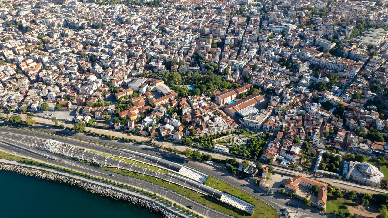
The former Kontoskalion harbor lay at approximately 41.001°N, 28.971°E on the Marmara shore of Istanbul's historic peninsula, in the Fatih district neighborhoods now known as Kadırga Limanı and Kumkapı. The site is unrecognizable from ground level, but from the air at 3,000–5,000 feet the flat terrain of the former harbor basin is faintly visible amid the dense urban fabric between the Hippodrome and the old sea walls. The nearest airport is Istanbul Airport (LTFM), approximately 36 km to the northwest. The Marmara Sea stretches south; the ancient Theodosian sea walls can be traced running east-west along the shore below.
Nearby Stories
- Kocaeli Peninsula 7.6 km away
- Second Battle of Çatalca 11 km away
- Istanbul's Rural Outskirts 14 km away
- MV Struma 20 km away
- HMAS AE2 36 km away
- Bursa 66 km away
- Sangarius Bridge 71 km away
- Januarius MacGahan 101 km away