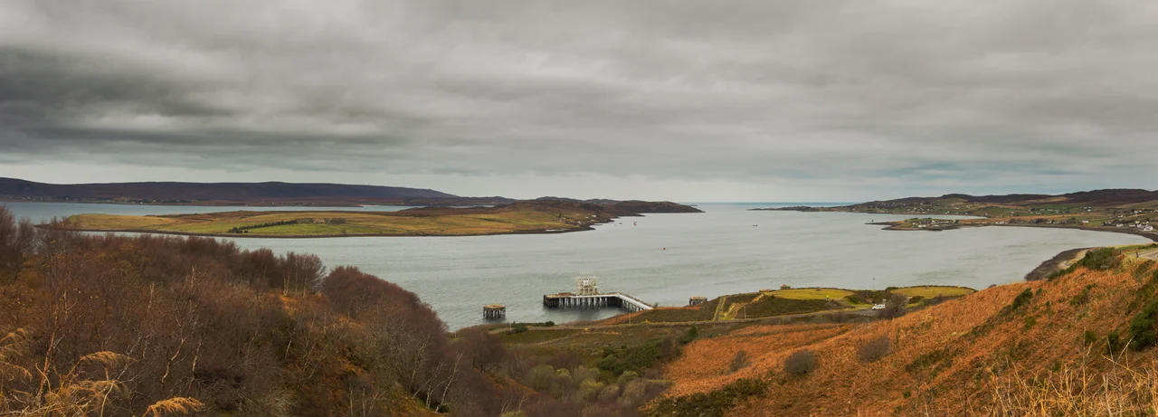

Loch Ewe
In September 1942 the disaster of Convoy PQ 17 was three months old and the Royal Navy needed a port the Luftwaffe had not yet learned to find. They chose a sea loch in Wester Ross that almost nobody outside the parish could pronounce. From that month until the German surrender, Loch Ewe was where Arctic convoys to Murmansk gathered in secret - ships from British, American and Allied ports rendezvousing beneath the hills before steaming north into the long winter night. The Highlanders watching from the crofts knew not to ask, and afterwards mostly not to tell.
Iron and Charcoal
The loch has always been an assembly point for someone. Around 1610, the head of Loch Ewe - the spot today called Poolewe - sprouted an iron furnace, fed by charcoal from the surrounding woodlands. English ironmasters had run the numbers and decided it was cheaper to bring the ore north by ship and smelt it under Highland skies than to drag boatloads of charcoal south to feed furnaces in England. For a generation, the smoke of an early industrial works drifted across what is now one of Scotland's quietest shores. The trees were felled, the furnace eventually died, and the loch fell back to its older rhythms. But the pattern was set. Distance, deep water, and rugged terrain meant that whenever Britain needed a back door on the Atlantic, Loch Ewe was an answer it kept returning to.
Crofters Counted by Name
The crofting villages along the shore were established in the 1840s, when the parish reformed its run-rig fields into fixed holdings. The 1841 census counted them with extraordinary precision. At Bualnaluib, nine miles north of Poolewe, eleven houses held fifty people - twenty-three of them McIvers. At Mellon Charles, four miles west, two hundred and sixteen people lived in forty-one houses, of which seventeen were headed by a McLennan. Ormiscaig, halfway between, had ten houses and forty-eight people, four of those houses headed by McGregors. A century and a half later the names had thinned with the populations: ten left at Bualnaluib, twenty-four at Ormiscaig, a hundred and ten at Mellon Charles. The Ross-shire dialect of Highland English still spoken in Poolewe and around carries the pre-aspirated consonants of those families - a long, soft *h* before a hard *k*, distant cousin to the Hebridean speech of Harris and Barra.
The Convoys
When the Second World War turned the North Atlantic into a hunting ground, Loch Ewe became a temporary base for the Home Fleet. After PQ 17 was scattered by German air and U-boat attack in July 1942 - one of the worst convoy disasters of the war - the Royal Navy needed a fresh assembly point that German intelligence had not yet mapped. From September 1942, ships gathered here under the hills, loaded for Murmansk. Crews came ashore at Aultbea to a village that suddenly held sailors from Halifax and Hull and Boston, and then vanished again into the loch at night. A lighthouse built in 1911 stood watch on the promontory between Gairloch and Poolewe. After the German surrender in April 1945, the loch took on a new role: the British marshalling point for U-boats that had surrendered while still at sea, brought in one by one through the same waters they had once tried to interdict.
Quiet Strategic Use
The war receded, but the strategic use did not. The naval boom defence depot at Mellon Charles marks the line of the original protective netting that once guarded the loch's entrance. Part of the base became a petroleum, oil and lubricants depot for visiting warships, and as of 2006 two NATO Z-berths were authorised at Mellon Charles for nuclear-powered submarines. Stand on the A832 north of Tournaig at dusk - the road locals call the midnight walk - and the loch below looks innocent: a long blade of dark water, hills shouldering it on either side. The strathspeys sung in local ceilidhs still remember the convoys. The Aird Point overlooks still offer the photo the tourists came for. And the Royal Navy, quietly, has never quite let go.
From the Air
Loch Ewe lies at 57.84N, 5.61W in Wester Ross, the Northwest Highlands of Scotland. The loch runs roughly north-south, opening to the Minch at its northern end, with Aultbea on the eastern shore and Poolewe at the head. From cruising altitude the Isle of Ewe sits like a stopper near the loch mouth. Nearest airport is Inverness (EGPE), 85 nautical miles east-southeast - the practical gateway to the entire Wester Ross coast. Approaches over the Cairngorms can be turbulent; coastal cloud and squall lines off the Atlantic are common.
Nearby Stories
- Stoer Head Lighthouse 6.8 km away
- Beinn Eighe 8.7 km away
- Tiumpan Head Lighthouse 13 km away
- South Rona 14 km away
- Battle of Tuiteam Tarbhach 17 km away
- Conon Hydro Scheme 22 km away
- Shiant Islands 23 km away
- Loch Naver 33 km away