
Lycus (river of Constantinople)
When Mehmet II chose the spot to pitch his personal tent before the final assault on Constantinople in 1453, he did not pick it at random. He set it on the high ground above a shallow valley carved by a stream his engineers knew well: the Lycus, the only river inside the walled city, and the single geographic weakness in one of the strongest defensive systems the ancient world ever built. That decision — tent on the ridge, attack through the valley — ended an empire. The Lycus itself, named for the wolf in Greek, is now entombed beneath the asphalt of Adnan Menderes Boulevard, but the valley it carved still shapes Istanbul's topography, and the story of the city cannot be told without it.
The River That Shaped a City
Six kilometers long, the Lycus was the sole drainage channel for the entire walled city of Constantinople. The valley it cut through the peninsula was substantial — up to 3.5 kilometers wide at its broadest — and it occupied roughly one-third of the total area enclosed by the Theodosian Walls. Geographically, the creek separated Istanbul's seventh hill to the west from the third, fourth, fifth, and sixth hills, a division that still subtly organizes the old city's neighborhoods today. The Lycus entered the city between the Gate of Charisius and the Gate of St. Romanus — modern Edirnekapı and Topkapı — slipping beneath the walls just south of the Fifth Military Gate. It then headed southeast, passing south of the Lips Monastery, and eventually reached the Forum Bovis, the great cattle market of the Byzantine city. For most of the year it ran thinly, barely more than a trickle. But the February rains would swell it with silt and debris, and that discolored water would fan out across the harbor's western and northwestern reaches, a seasonal reminder that the city's interior was not as impervious as its walls suggested.
A Valley That Proved Fatal
The Theodosian Walls, which protected Constantinople for over a thousand years, were formidable everywhere except where the Lycus valley interrupted them. There the ground dipped, the walls could not be built quite as high, and the angle of approach from outside was more favorable to attackers. Byzantine defenders knew this. Ottoman strategists knew it too. Mehmet II's siege plan was methodical: wear down the defenders at Blachernae in the north, then concentrate the decisive blow through the Lycus valley. On the morning of May 29, 1453, that is exactly what happened. The sultan had set up his command position on the high ground overlooking the valley — visible to his troops, and to the defenders on the walls. The final assault came through that dip in the terrain, and Constantinople fell within hours. What the Lycus carved through the peninsula over millennia, a conquering army used in a single night.
An Emperor Dies Hunting
Long before the Ottomans arrived, the Lycus valley had already claimed one emperor. In 450 CE, Theodosius II — the ruler who had commissioned the great land walls that bore his name — was out hunting in the valley near Constantinople when his horse threw him. He fell badly, struck by the fall, and died from his injuries. The emperor whose walls would stand for a thousand years died in the very valley that those walls were most unable to protect. The irony is the kind that Byzantine chroniclers noticed and recorded. The valley was not wilderness — monasteries lined its banks, including those of Dios, Ikasia, Cocorobion, and the Lips Monastery — but it remained open enough, and low enough, to feel like country even within the city's boundaries.
Buried and Briefly Rediscovered
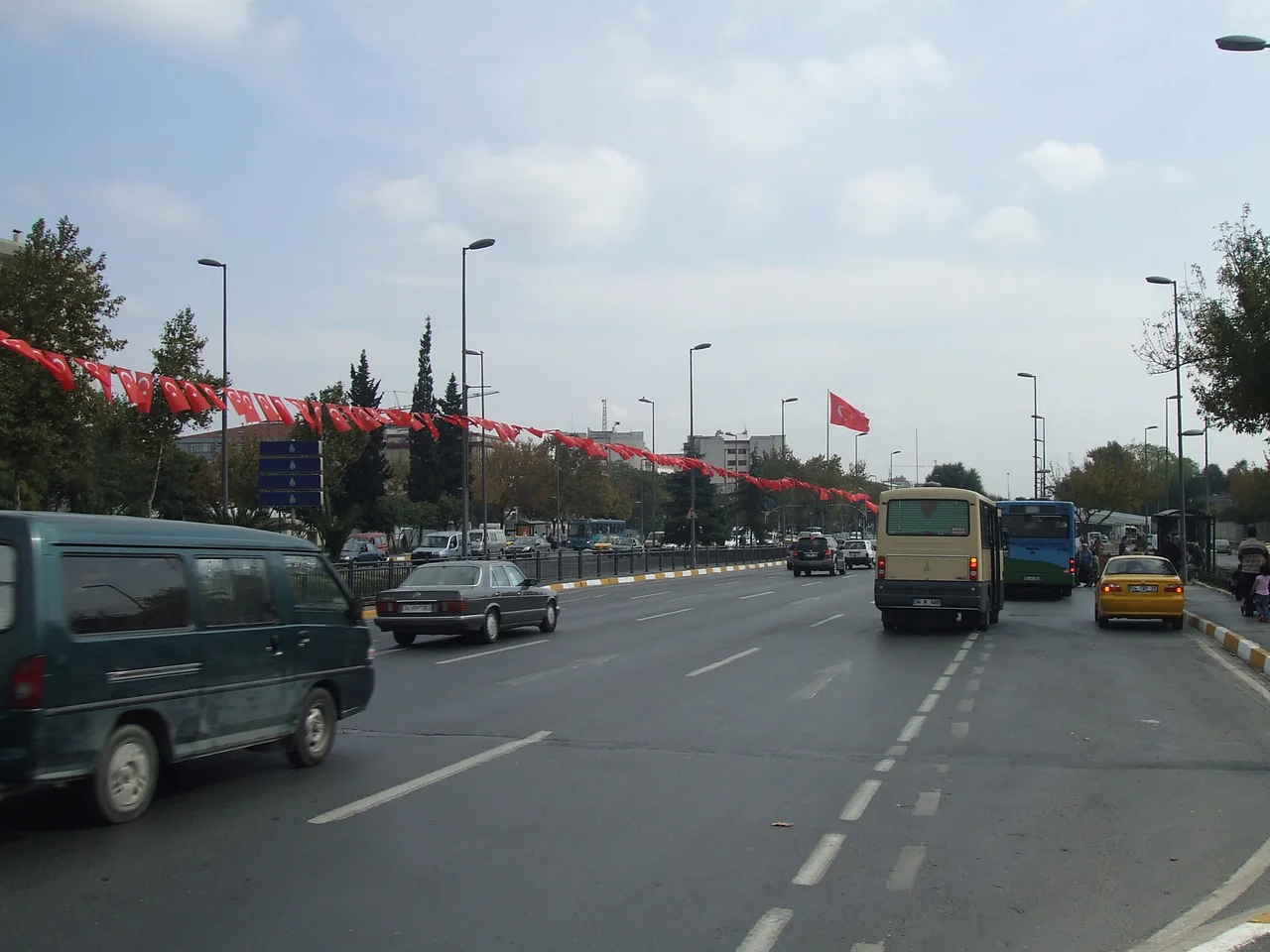
By the Ottoman period, old maps show the lower course of the Lycus — south of the Lips Monastery — had already gone underground, redirected into subterranean channels that the Byzantines had apparently begun. The Ottomans inherited that buried river along with everything else. In the 1950s, during the urban clearances and road-building campaigns that remade so much of old Istanbul, the remaining visible stretch of the creek was covered over to create the Vatan Caddesi, now Adnan Menderes Boulevard — a broad avenue that follows the old valley with an almost geographic faithfulness, even if most drivers do not know that. Construction of the M1 metro line briefly exposed a section of the ancient streambed, giving archaeologists a rare look at a waterway that had been invisible for decades. Then it was covered again. The Lycus flows on underneath the city, wolf in name and nature — unseen, but present.
From the Air
The Lycus valley runs roughly northwest to southeast through the Fatih district of Istanbul, centered around coordinates 41.0065°N, 28.9506°E. From cruising altitude over the European side of Istanbul, look for the wide, slightly depressed corridor between the city's hills — now the route of Adnan Menderes Boulevard — that leads from the old land walls near Edirnekapı down toward the Sea of Marmara. The Theodosian Walls are visible as a green-lined fortification line on the western edge of the built-up peninsula. Nearest major airport: LTFM (Istanbul Airport), approximately 35 km to the northwest. Approach from the northwest offers a clear view of the land walls and the valley corridor. Visibility permitting, the Topkapı Palace district is visible at the peninsula's tip to the southeast.
Nearby Stories
- Kocaeli Peninsula 7.6 km away
- Second Battle of Çatalca 11 km away
- Istanbul's Rural Outskirts 14 km away
- MV Struma 20 km away
- HMAS AE2 36 km away
- Bursa 66 km away
- Sangarius Bridge 71 km away
- Januarius MacGahan 101 km away