Mache-Chindul Ecological Reserve
The upper mountains here are rarely dry. Haze drifts in off the Pacific and snags on the ridges of the Mache-Chindul range, keeping the canopy wet long after the coastal plain below has baked. This is the northern tip of Ecuador's coastal cordillera, isolated from the Andes by about 100 kilometers of plain, and it is one of the last meaningful remnants of the Choco forest on Ecuadorian soil. The reserve spans almost 120,000 hectares of that forest, protecting a transition zone where the drenched rainforests of the north grade into the seasonally dry forests of Manabi further south. Within its borders live more than 1,100 species of vascular plants, 491 species of birds, 136 species of mammals - and Chachi and Afro-Esmeraldas communities who have called these hills home for centuries.
Where the Forests Change
Most ecological reserves protect a single ecosystem. Mache-Chindul protects the seam between two. In the north, the hills catch up to 3,000 millimeters of rain a year and support the kind of wet tropical forest most associated with the Colombian Choco - tall emergent trees dripping with orchids, lianas looping down to the understory, long-wattled umbrellabirds calling from hidden perches. South of the Cojimies and Jama region, rainfall drops to around 1,000 millimeters, and the forest thins into the Ecuadorian dry forests, where ceibo trees shed their leaves during the long southern dry season and cactus appears among the holy-wood trees. That transition is not a line on a map. It is a slow shift you can walk through, and the reserve's biodiversity is partly a product of overlap - species from both ecosystems share the same protected mountains.
The Community Inside the Forest
Long before the reserve was created in 1996, Chachi communities lived in the Mache-Chindul forests, and Afro-Esmeraldas communities - descendants of Africans who escaped enslavement on the coast - built villages in and around them. Their traditional uses of the forest - hunting, fishing, small-scale farming, the harvesting of palms such as tagua and pambil - have shaped the landscape as surely as rainfall has. When the Ecuadorian government formalized protection on 9 August 1996, it did so with these communities already present. The challenge, one faced by reserves across the tropics, is honoring that presence: finding ways for protected-area management and longstanding community use of the land to coexist. The reserve's headquarters can be reached by driving 20 kilometers north of Quinindé on highway 20, then another 17 kilometers on a dirt road that in the wet season only four-wheel drive vehicles can manage.
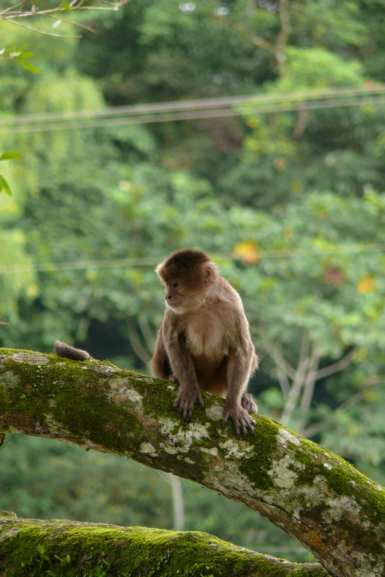
Bilsa, the Biological Heart
The Jatun Sacha Foundation established the 3,000-hectare Bilsa Biological Station here in 1994, two years before the surrounding reserve was created. Bilsa became the scientific engine of the region. Since 1996 it has hosted the Center for Conserving Plants of the Western Forest, which produces around 100,000 trees a year - 80 species of tropical fruit trees and 50 of local timber - for reforestation inside and outside the reserve. Automatic cameras have documented jaguars, ocelots, margays, jaguarundis, giant anteaters, and the endangered brown-headed spider monkey moving through the buffer zone. The station's bird list reads like a who's-who of Choco specialties: banded ground cuckoo, black-tipped cotinga, Choco toucan, Choco poorwill, grey-backed hawk. Researchers describe species from this forest into scientific journals year after year. A new genus of trees, Ecuadendron, was first identified from plants collected here.
Pressure From All Sides
The reasons the reserve exists are the same reasons it remains under strain. The timber in these mountains is valuable. The soil will grow cattle and sugar cane. The forest borders on large agricultural interests and on settlers pushing in along new roads. In 1991, before the reserve was declared, large patches of old forest still held sizeable timber trees, but loggers were already cutting. Establishment of the reserve slowed that destruction. In 2002, UNESCO recognized the 113-hectare Cube Lagoon inside the reserve as a Ramsar wetland of international importance, for its biodiversity and for the services it provides to nearby communities. By 2005 the forest inside the boundaries was assumed to be increasingly fragmented, but still largely intact - a hopeful note in a region where other patches of the coastal Choco had already been reduced to thin islands in a sea of oil palm.
From the Air
The reserve covers coastal mountains at approximately 0.48N, 79.78W, rising from lowlands to ridges around 800 meters. The nearest airports are Esmeraldas (SETN) to the north and Manta (SEMT) to the south. Recommended viewing altitude is 5,000-8,000 feet AGL; cloud cover clinging to the ridges is common year-round and thickest in the morning. The flooded Cube Lagoon is visible as a distinct water body among otherwise forested terrain.
Nearby Stories
- San Miguel (Ecuador) 21 km away
- Esmeraldas, Ecuador 28 km away
- 1942 Ecuador earthquake 40 km away
- Mindo 41 km away
- Bellavista Cloud Forest Reserve 69 km away
- Canoa 78 km away
- Bahia de Caraquez 119 km away
- Malpelo Plate 306 km away