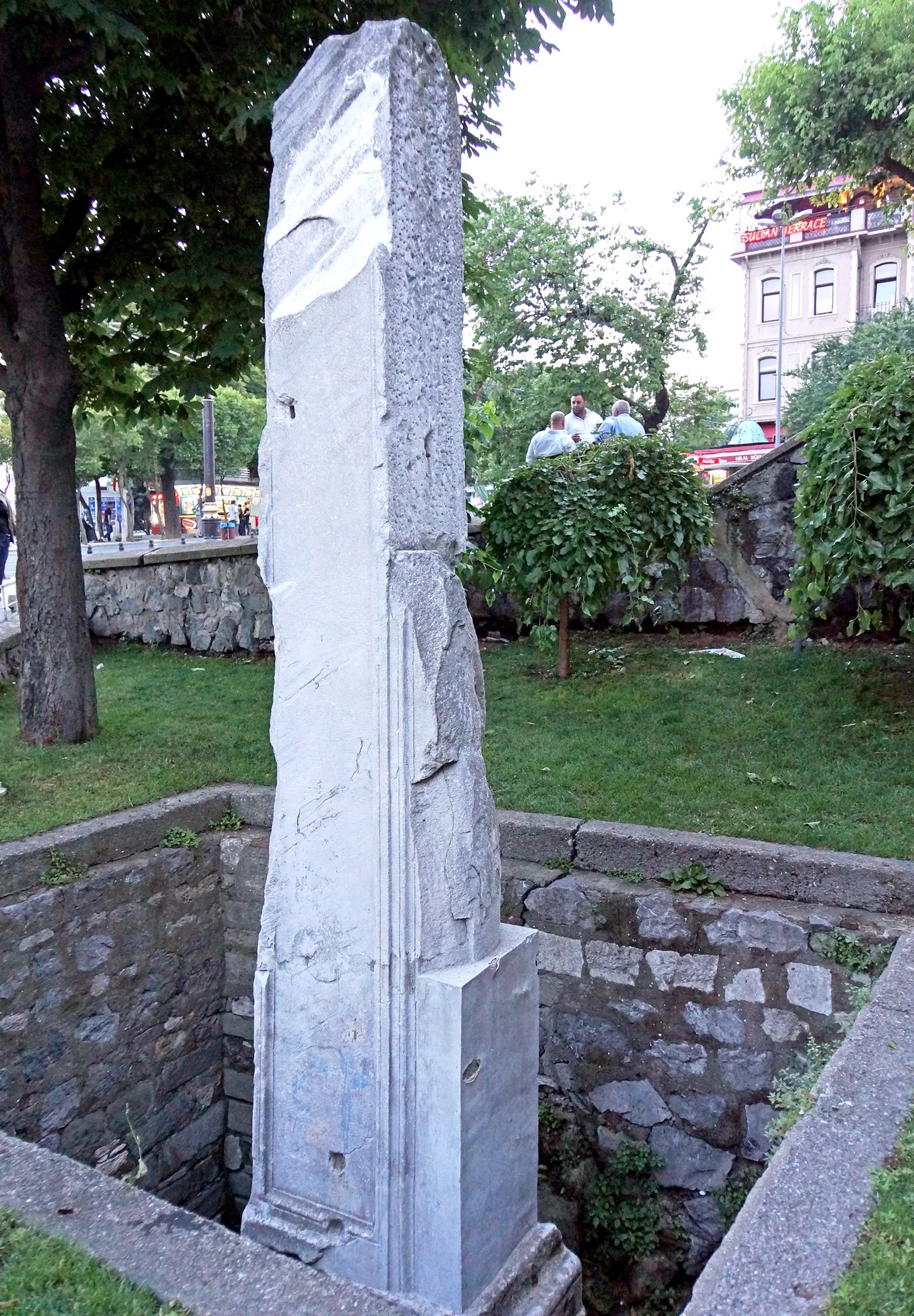

Milion
Every road in the Eastern Roman Empire began here. Not at a boundary, not at a gate, but at a gilded monument just west of the Augustaeum square, within sight of the Hagia Sophia, in the heart of the city that Constantine had declared the new Rome. The Milion — from the Latin milliarium, a milestone — was the zero point from which all distances across the empire were measured and inscribed on its base. Alexandria, Antioch, Jerusalem, Thessaloniki: every major city of the Byzantine world was a fixed number of miles from this spot. The monument is largely gone now, but a single re-erected column fragment still stands in Istanbul's Sultanahmet neighborhood, easy to miss, impossible to forget once you know what it represents.
A Monument Older Than the Empire
The Milion's origins predate Constantinople itself. Septimius Severus raised it in the 3rd century AD in the older city of Byzantium, before Constantine chose the site for his capital. When Constantine refounded the city as Constantinople in 330 AD, the Milion became the zero-mile marker not just of a city but of an empire. Its function was identical to that of the Milliarium Aureum — the Golden Milestone — that Augustus had placed in the Roman Forum centuries earlier, designating Rome as the origin point of all roads. Constantinople now claimed that same role, and the Milion made the claim physical. On its base were inscribed the distances of all the main cities of the empire from this point.
A Domed Monument Crowned in Statues
The Milion was no simple stone. It can be described as a double triumphal arch surmounted by a dome, carried on four great arches. Over the centuries it accumulated decoration: statues of Constantine and his mother Helena flanking a cross, both figures oriented to look east — toward the rising sun and the direction of Jerusalem. A statue of Theodosius II stood there as well, and a bronze quadriga of Helios, the sun god, whose four horses once pulled his chariot across the sky in ancient mythology. The monument sat just west of the Augustaeum, the great ceremonial square adjacent to the Hagia Sophia, and it marked the starting point of the Mese, the colonnaded main avenue that ran through the entire city.
Disappearance and Rediscovery
After the Ottoman conquest of 1453, the Milion survived intact for several more decades. Then, sometime in the early 16th century, it disappeared — likely demolished during the enlargement of a nearby aqueduct and the construction of a suterazi, a water distribution tower the Ottomans built to manage the city's water supply. The monument that had anchored Byzantine geography for over a thousand years was absorbed into the infrastructure of its successor civilization. It was not rediscovered until 1967 and 1968, when demolition of buildings above the site and subsequent archaeological excavations revealed foundations and a fragment of the original structure. That fragment — re-erected as a pillar — stands in the open air today, marked with a modest sign.
The Weight of a Zero Point
What the Milion meant in practice was administrative precision at imperial scale. Roads were surveyed, distances posted, and tax calculations, travel times, and military logistics all traced back to this one spot. The pillar nearby still shows, in a display panel, the distances from the Milion to major modern cities — a continuation of the monument's original function, updated for a different world. Constantinople itself no longer exists as a political entity, but the geography it organized persists. The Milion's location is now a quiet corner of tourist Istanbul, a few steps from the entrance to the Basilica Cistern. The scale of what once stood here — the gilded arches, the bronze quadriga, the inscribed distances of a world-empire — has to be imagined.
From the Air
The Milion stands at approximately 41.008°N, 28.978°E in the Sultanahmet quarter at the tip of Istanbul's historic peninsula. Flying into Istanbul Airport (LTFM) from the west, the entire peninsula is visible on final approach — Hagia Sophia's great dome unmistakable, and the Sultanahmet area directly beside it. The Milion sits within meters of the Hagia Sophia's northwest corner. At 3,000–4,000 feet, the spatial logic of Byzantine Constantinople becomes clear from above: the palace zone at the peninsula's tip, the Hippodrome to the south, and the Mese running westward from this point.
Nearby Stories
- Kocaeli Peninsula 7.6 km away
- Second Battle of Çatalca 11 km away
- Istanbul's Rural Outskirts 14 km away
- MV Struma 20 km away
- HMAS AE2 36 km away
- Bursa 66 km away
- Sangarius Bridge 71 km away
- Januarius MacGahan 101 km away