Rhine-Herne Canal
On 14 July 1914, two weeks before the world went to war, the German empire finished cutting a forty-five-kilometer ditch through the heart of the Ruhr. The Rhine-Herne Canal had taken eight years to build and was, on opening, the most ambitious piece of inland-water infrastructure the empire had ever attempted - a horizontal coal highway running from the Rhine at Duisburg, east along the Emscher valley, through every major mining city of the central Ruhr, ending at the Henrichenburg boat lift where it joined the Dortmund-Ems Canal. The cargo was specific. So was the boat. The engineers had designed a vessel exclusively for this canal - the Rhein-Herne-Kanalschiff, 80 meters long, 9.50 wide, 2.50 meters draft, carrying 1,300 to 1,350 tonnes of coal. Each lock on the canal was sized to within centimeters of these dimensions. The boat fit the canal. The canal fit the boat.
Five Locks and the Pumps That Feed Them
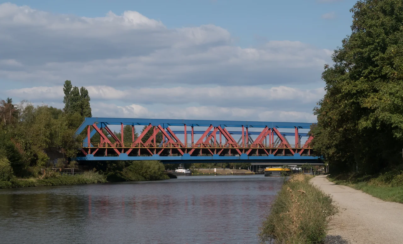
Water rises across the run. The canal climbs in five steps from Rhine level at Duisburg to the upper Dortmund-Ems junction, with locks at Duisburg-Meiderich, Oberhausen, Gelsenkirchen, Wanne-Eickel, and East Herne. Each lock needs water to operate, and the engineers solved that by installing a pumping station at each stage that lifts Rhine water up to the next chamber. Additional water comes from the east through the Datteln-Hamm Canal, which siphons off the Lippe River. The whole system is artificial - a staircase of water held in place by sluice gates and pumps. In 1980 the Duisburg-Meiderich sluice was rebuilt with a 24-meter under-gate and control platform painted bright yellow, now a visible landmark across the Ruhr industrial sky. The new lock chambers are 190 meters by 12, large enough for Euro Class II barges with pushed lighters.
A Necklace of Industrial Harbors
What makes the Rhine-Herne distinctive is not the canal itself but the chain of ports that hang off it. The Stadthafen Gelsenkirchen opened in July 1914, the same week as the canal, and is the oldest port on the run. Its water surface covers nearly twelve hectares and it now handles petroleum products and grain - it is the second-largest inland grain port in North Rhine-Westphalia. The Stadthafen Essen, opened by the city in 1934, is the youngest, with sixty-three thousand square meters of water and three hundred thousand of dockland for solid fuels, petroleum, stone, and recycled materials. Port Grimberg, built in 1914 by the Gelsenkirchener Bergwerks-AG to supply the Schalker steelworks, was once one of the busiest iron-ore ports on the canal. The Schalker works closed in 1982, and Port Grimberg now sits mostly empty, used for recycled building materials and storage. Westhafen Wanne was filled in to make room for the Guterverkehrszentrum Emscher logistics hub. Osthafen Wanne, abandoned for decades, was resurrected in 2007 when the company United Mills installed a grain loading plant and new silos.
The Ports of Dead Mines
Some of the harbors along the canal are still named for the collieries they were built to serve, even though those mines have been closed for decades. The Hafen der Zeche Konig Ludwig handled coal going out and supplies going in for the King Ludwig mine. The Hafen der Zeche Friedrich der Grosse served the Frederick the Great mine. Both lie near kilometer 38, on opposite banks of the canal just upstream of the Herne East lock. Neither pit exists now. The harbors remain, partly because the canal walls are too expensive to remove, partly because nothing better has come along. The Friedrich der Grosse port is now an industrial estate. The Konig Ludwig port still has its cut, parallel to the canal, but no infrastructure on it. Port Rutgers, downstream, belongs to Rutgers Chemicals - founder Julius Rutgers - and still handles pitch from the refining of coal tar, a product that has somehow survived everything else.
The Yacht Marina and the Sealife
Modern recreation arrived in 2004. The Oberhausen marina opened next to the CentrO shopping center - a 2.5-meter-deep yacht harbor with thirteen bridges, surrounded by Sealife Oberhausen and the Oberhausen Modellbahn World. Pleasure craft now share the canal with the few remaining coal lighters and the petroleum barges and the United Mills grain ships. Eels, carp, zander, bream, roach, and rudd live in the water. Pike and rainbow trout appear less often. The Emscher river runs parallel to the canal in many places and was, until recently, the open sewer of the Ruhr; the slow ecological recovery of the Emscher in the twenty-first century has begun to feed back into the canal too. The fish came back. The boats are slower than they used to be.
Ending at the Lift
After forty-five-point-six kilometers the Rhine-Herne meets the Dortmund-Ems Canal at the 14.7 km mark of that older waterway, at the foot of the Henrichenburg boat lift in Waltrop. The 1899 lift is the spectacular relic; a 1962 successor lift sits next to it (out of service since 2005); and a 1989 ship lock does the actual work today. The Rhine-Herne terminates at this complex, in what is now called the Waltrop Lock Park, and pleasure boats moor there for the night. The cities the canal passes through on its way to Waltrop read like a roll call of the Ruhr industrial era - Duisburg, Oberhausen, Essen, Bottrop, Gelsenkirchen, Herne, Recklinghausen, Castrop-Rauxel, Waltrop, Datteln. Almost every name on that list is a former mining or steel town. The canal is the thread that connected their industries to each other and to the sea. Most of the industries are gone. The water keeps moving.
From the Air
The Rhine-Herne Canal runs east-west across the central Ruhr at roughly 51.53 degrees North. Its western end is at the Rhine in Duisburg-Meiderich (51.45N, 6.74E); its eastern end is at Henrichenburg, Waltrop (51.62N, 7.33E). The midpoint reference is approximately 51.5311 degrees North, 7.0569 degrees East, near the Gelsenkirchen port. From the air the canal is a straight, dark blue line running through a dense urban-industrial landscape, with its five locks visible as distinct rectangular widenings and the bright yellow Duisburg-Meiderich sluice as a clear landmark at the western end. The nearest major airports are Dusseldorf (EDDL / DUS) about 25 km south of Duisburg, and Dortmund (EDLW / DTM) just east of the canal's terminus.
Nearby Stories
- Engels-Haus 6.9 km away
- Hochschule Niederrhein 7.7 km away
- Wesel Station 8.6 km away
- Gerleve Abbey 10 km away
- Hamm (Westfalen) Hauptbahnhof 11 km away
- Oude IJsselstreek 20 km away
- Warendorf 21 km away
- Atta Cave 26 km away