
Samicum
There is only one way through here, and there always has been. Between the ridge of Kleidi Hill and the Ionian coast, a narrow strip of land squeezes the road between mountain and sea, and whoever held that passage held western Greece. The ancient city of Samicum was built precisely to hold it. From the Bronze Age through the Macedonian invasions, from the cyclopean walls of the earliest settlement to the Christian temple layered over a Roman bath, Kleidi Hill accumulated centuries the way cliffs accumulate barnacles — without fanfare, one layer at a time.
The Pass That Made a City
Strabo, writing in the first century BCE, noted that the name Samos once meant simply 'heights' in the old tongue — and from heights you could see everything that mattered. The narrow defile between the mountain and the sea left armies, merchants, and ambassadors no alternative route. From its spur above the Anigrus lagoon, Samicum watched the road. According to Homer, this was the territory of Arene, a city placed near the mouth of the Minyeius; later geographers debated the exact identification, but the strategic logic was clear enough. Philip V of Macedon understood it in 219 BCE when he took the fortress by force. The Aetolian Polysperchon had seized it before him, pressing it against the Arcadians. Control of the pass was a recurring prize, not a permanent possession.
Where Six Cities Made Their Prayers
Below the hilltop fortifications, close to the shore and surrounded by a grove of wild olive trees, stood the sanctuary of the Samian Poseidon. This temple was the religious center of the six cities of ancient Triphylia — Samicum, Macistus, and their neighbors — all contributing to its upkeep under the supervision of Macistus, the most powerful among them. The arrangement was unusual: a shared sanctuary, maintained collectively, anchoring a loose confederation of coastal communities. Pausanias recorded it. So did Strabo. Both also noted the fetid lagoon fed by underground springs just south of the hill, its waters said to be poisonous to fish and unwholesome to breathe in summer. Ancient myth explained the smell by having the Centaurs wash their wounds here after their battle with Heracles. In the cliffs above the lagoon, two sea-caves opened: one sacred to the Nymphs Anigrides, one to the Atlantides. Pilgrims came to the cave of the Anigrides to pray before bathing in the medicinal waters, which were reputed to cure skin diseases. By 1835, when General Gordon visited, the caves could only be reached by boat — rising water had sealed them from the shore.
Layers That Time Didn't Erase
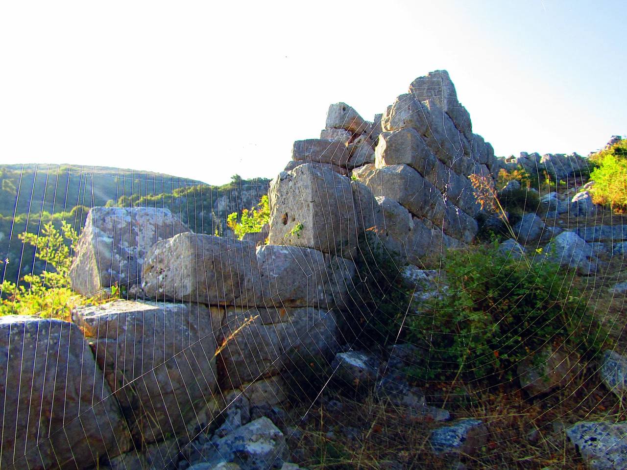
The ruined walls on Kleidi Hill are 2 meters thick and run nearly 2.4 kilometers in circuit — constructed in what archaeologists classify as the second order of Hellenic masonry, careful stonework from an era before mortar was widely used. The Bronze Age necropolis to the east yielded rich grave goods. A large tumulus excavated in 1954 by Nikos Yaluris received the name 'Iardanus's Tomb' from a passage in Strabo, connecting the mound to a figure the ancient geographer mentioned in this vicinity. The eastern hill, Elliniko, held the Classical acropolis, which remained in use from the fourth century BCE into Roman times; Roman baths and a Paleo-Christian temple were built just to its north, stacking the sacred and the civic over the older civic and sacred. In 2023, archaeologists working within the site of the Poseidon sanctuary identified the remains of an early temple-like structure — possibly dedicated to the god — the most recent discovery in a site that keeps yielding more.
What the Lagoon Still Holds
The two lagoons that Strabo and Pausanias described still trace the coast, shaped by the same topography that shaped Samicum's history. The larger one stretches north from the base of Kleidi Hill toward the mouth of the Alpheius. The smaller one cups the southern and western edges of the hill, fed by the same subterranean sources that made the water smell of sulfur in antiquity. The Anigrus still flows into that southern lagoon before finding the sea. General Gordon's yellow sulfur is still there in the rock. The hill itself is still there — a projecting spur between water and water, commanding the only road — and the walls that once guarded that road still stand in their courses, unchanged in their purpose even as the kingdoms that built them have vanished entirely.
From the Air
Samicum sits at 37.534°N, 21.599°E on the Triphylian coast of the western Peloponnese. The hill of Kleidi is visible from the air as a rocky promontory pushing toward the coast between two lagoons — the geometry of the pass is immediately legible from altitude. Approach from the Ionian Sea at 3,000–5,000 feet for the clearest view of the coastal configuration: the lagoons flanking the hill, the narrow land passage, and the pine-fringed shore. Nearest major airport is LGRX (Araxos), approximately 65 km to the north. Visibility is generally excellent along this coast; morning light from the east illuminates the hillside ruins well.
Nearby Stories
- Aroanios 4.6 km away
- Kyparissia 4.7 km away
- Strofades 7.6 km away
- Arcadia (region) 9.1 km away
- Longanikos 9.5 km away
- HMS Perseus (N36) 21 km away
- Astras 23 km away
- St. Mark's Roman Catholic Church 34 km away