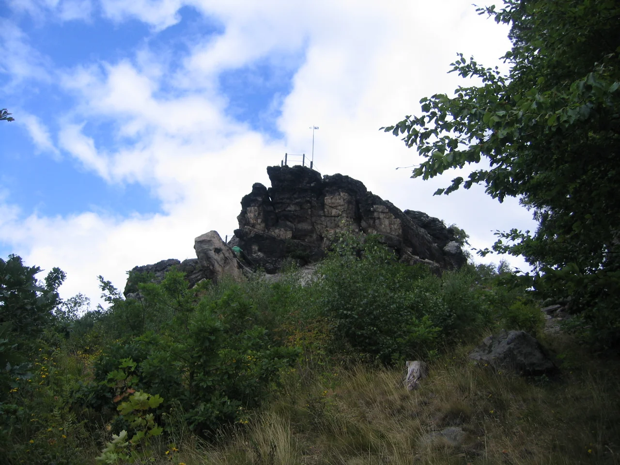

Teufelsmauer
In the version told around Timmenrode, the Devil lost the Harz because a farmer's wife tripped on a pebble. He had wagered the Lord that he could raise a boundary wall in a single night, as high and as strong as an emperor's buildings, and take the ore-bearing mountains for himself while God kept the fertile plains. The wall went up in the dark. Then a woman carrying a cockerel to market stumbled, the bird stretched its neck in the basket and crowed, and the Devil — thinking dawn had beaten him — hurled the last stone at his own work and smashed most of it down. What is left is the Teufelsmauer, and it runs, in fragments, for twenty kilometres along the northern rim of the Harz.
Rock Turned Upside Down
The wall is real enough, and its geology is stranger than the legend. These are hard sandstones from the Upper Cretaceous, laid down flat as marine sediments and then caught in the uplift of the Harz along the Northern Harz Boundary Fault. Along the whole northern edge of the range the strata were tilted and folded so violently that the layers now stand on end or lie inverted — the surface beds are upside down. Silicic acid seeping through some of those beds cemented and hardened them into near-quartzite, in bands only a few metres thick. Then time removed everything softer. What survived is a set of prominent ribs of rock standing up to twenty metres above the surrounding fields, with gaps where rivers and Ice Age glaciers took sections out. The Devil's version, in other words, gets the shape right: a wall, unfinished, with pieces missing.
Three Surviving Fragments
The band outcrops in three places between Ballenstedt in the southeast and Blankenburg in the northwest. It starts with the Gegensteine northwest of Ballenstedt, weathered from a silicified stratum of the Emscher epoch. It reappears as the jagged two-kilometre ridge running from south of Weddersleben toward Warnstedt, where the Königstein, the Mittelsteine and the Papensteine rear out of the ground; these are younger, undisturbed Senonian beds, and the ridge reaches its high points at the Mittelstein, 185.2 metres above sea level, and the Königstein at 184.5, standing some fifty metres proud of the Bode below. This stretch is also known as the Adlersklippen, the Eagle Crags. Northwest again, between Timmenrode and Blankenburg, quartzitic Santonian sandstone forms a steeply tilted ridge that includes the Hamburger Wappen, the Heidelberg at 331.5 metres and the crags called Großvater and Großmutter, grandfather and grandmother, at 317.
Protected Before Protection Was Invented
This sandstone was excellent building material and there was a market for it, which very nearly cost the Teufelsmauer its existence. Protection orders were issued as early as 1833, and again in 1852 by the head of the district authority, specifically to keep the quarrymen off. In 1867 Otto Stielow stopped the community of Weddersleben from working the rock as a quarry altogether. In 1935 the Teufelsmauer near Weddersleben was made a nature reserve, which puts it among the oldest protected areas in Germany — a conservation record that predates the concept of conservation as most countries would recognise it. The pressure now comes from admiration rather than extraction. Rare plants on the sandy ground have made visitor management necessary, so the rocks are approached on marked trails and the viewpoints are fenced with safety railings.
Thyme, Lichen and Flint
The soils here are thin, sandy and poor in nutrients — regosols and lithic leptosols weathered straight off the rock — and the vegetation that suits them is the pioneer community of open, sunny sand: grey hair-grass and blue fescue, threaded with Breckland thyme, sheep's-bit and Carthusian pink. Warmth-loving plants do well on the south-facing faces, among them viper's bugloss, flixweed and St Lucie cherry, alongside continental species like field eryngo, field mugwort and spotted knapweed. The rock itself carries little more than a light crust of lichen. People have been coming for a very long time. Archaeological finds along the wall include traces of the Old Stone Age, of the Linear Pottery culture that brought farming to central Europe, and of the Bronze Age. The wall is a landmark in flat country, and it has been used as one for millennia.
The Wall in the Telling
The Grimm brothers collected a version of the story in which the Devil and God contend for dominion over the earth and settle on a division of the land, with the rocks marking the border and the Devil building his wall in triumph, dancing as he works — the Hexentanzplatz above Thale sits in the same landscape and the same legend. Another variant sets the cockerel in the basket of a market woman from Cattenstedt on her way to Blankenburg, with one stone still missing from the wall when the bird crows. What is worth noticing is what the Devil bargains for. He does not want the fertile plains; he wants the ore-bearing mountains. This is a story told by people who lived off metal, in a place where the mountains really were worth more than the fields. The formations, all reachable on foot from Thale and Blankenburg, appeared on screen in François Ozon's 2016 film Frantz.
From the Air
The Weddersleben section lies at 51.7575°N, 11.0831°E. From the air the Teufelsmauer is one of the most distinctive small features in northern Germany: a pale, thin, broken line of rock running northwest to southeast across otherwise flat farmland, tracing the boundary between the wooded Harz and the Harz Foreland for about 20 km between Ballenstedt and Blankenburg. It is best seen with low sun, when the ribs throw shadows across the fields and the gaps in the wall read clearly. The mouth of the Bode Gorge at Thale sits a few kilometres south, and the Brocken dome is about 30 km west-northwest. Recommended altitude is 1,500-3,000 ft AGL — the formation is only tens of metres high and vanishes into the field pattern from any higher. Nearby airports include EDDP (Leipzig/Halle) to the southeast, EDVE (Braunschweig-Wolfsburg) to the north and EDDV (Hannover) to the northwest. The terrain here is gentle, but the ground rises quickly to the south into the Harz proper.
Nearby Stories
- Domfelsen 10 km away
- Kyffhäuser Monument 10 km away
- Schöningen spears 13 km away
- Herzog August Library 15 km away
- Upper Harz Water Regale 15 km away
- German National Academy of Sciences Leopoldina 25 km away
- 1st German Bratwurst Museum 36 km away
- Magdeburg Cathedral 40 km away