
Upper Harz Water Regale
Every metre a Harz miner cut downward, water came up to meet him. A few metres below the surface the seepage was already serious enough to slow the work; at three hundred metres it was an existential problem, and by 1830 the deepest workings had passed six hundred metres and were below sea level — a fact contemporaries found genuinely unsettling. The only way to lift that water out was water power. So the miners spent four centuries rebuilding the drainage of an entire mountain range to feed the wheels that kept the mines from drowning. The result covers roughly 200 square kilometres, and most people walking through it think they are looking at a nice pond.
A Right Granted by Kings
Regale means a royal prerogative, and the Upper Harz ran on two of them. Through the Bergregal a monarch granted the right to mine; through the Wasserregal he granted the right to take the water needed to work the mine. Everyone else in the catchment — mill owners in particular — came second, by law. That legal architecture, part of the wider Bergfreiheit, remained on the books in Lower Saxony until the 1960s.
The reason a king would sign such a thing was silver. The Upper Harz produced copper, lead, iron and later zinc, but silver paid the bills, and between the sixteenth century and the middle of the nineteenth roughly 40 to 50 percent of all German silver came out of these hills. The taxes went to the royal houses of Hanover and Brunswick-Wolfenbüttel and helped hold their position inside the Holy Roman Empire. A hillside near Clausthal was, in a real sense, a pillar of statecraft.
Water Servants and the Whim
Before the system existed, drainage was muscle. Men called Wasserknechte — water servants — stood on ladders in the shafts passing leather buckets upward, hour after hour. Horses driving whims came next: far more capacity, but expensive, and needing replacement every few hours as they tired.
Water wheels changed the arithmetic. They also introduced a brutal feedback loop: when drought stopped the wheels, the pumps stopped, and the water in the mine rose until the workings drowned and the miners were put out of work. Rather than sit idle, the miners used exactly those periods to dig more ditches and raise more dams. The Upper Harz Water Regale was largely built during the dry spells that shut the mines down — a system constructed, piece by piece, out of its own failures.
Five Hundred Kilometres of Ditch
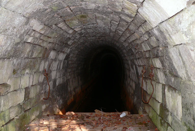
The principle is simple and the execution is not. Ditches run almost along the contour, catching surface runoff and walking it slowly across the slopes toward the mines. Some are ten kilometres and more — the Dammgraben, the Upper Schalke Ditch. Where the water was not needed immediately it went into artificial ponds held behind earth dams, banked against drought, then released through bottom outlets into another ditch. Wheels were arranged in cascades so a single flow could be used several times over, which meant the water had to be collected and carried at the highest elevation the terrain allowed.
At its full extent the system ran to 143 dammed ponds, 500 kilometres of ditch and 30 kilometres of tunnel, plus around 100 kilometres of drainage adits — though never all at once. The engineering it forced into being travelled well beyond the Harz. The man engine, which carried miners up and down on reciprocating rods rather than ladders, was first rigged at Clausthal in 1833 by Wilhelm Albert and Georg Dörell. Wire rope came from the same place and the same problem.
The Oderteich
The most impressive single structure was proposed in 1712 by a deputy chief miner named Caspar Dannenberger, authorised in September 1714 by the Elector of Hanover — by then also King George I of Great Britain — with a budget of 3,048 thalers and 27 groschen, and built between 1715 and 1722 by miners from Sankt Andreasberg.
The Oderteich stands 22 metres high and 153 metres long, holds 1.7 million cubic metres, and solved its sealing problem with an idea nobody had tried at that scale: tamped granite grus, the coarse sand that Harz granite weathers into, packed into the dam as a watertight core. It worked, and it kept working. From its completion in 1722 until the Eschbach Dam was finished in 1891, the Oderteich was the largest dam in Germany — 170 years at the top, built by working miners without an engineering profession to consult.
Still Carrying Water
Mining in the Upper Harz wound down between the wars and finished at Bad Grund in 1992. The water did not stop running. From 1930 it was turned to electricity, generated by Preussag at the Kaiser Wilhelm and Ottiliae mines until the early 1980s; the Samson Pit at Sankt Andreasberg still has turbines underground, at 130 and 190 metres down, fed from the Oderteich along the Rehberg Ditch.
Since 1991 the Harzwasserwerke has maintained 65 ponds, 70 kilometres of ditch and 20 kilometres of tunnel, at a seven-figure annual cost carried entirely by drinking-water sales rather than public money — several ponds now supply the taps in the towns below. Hundreds of kilometres of older ditch and dozens of ruined dams are left as passive protected monuments, permitted to decay slowly but not to be destroyed. In 2010 UNESCO extended the Rammelsberg and Goslar World Heritage listing to take in the whole system. In summer, people swim in it.
From the Air
The Upper Harz Water Regale is a landscape rather than a building, centred near 51.8200°N, 10.3400°E around Clausthal-Zellerfeld (2 km) and spread over roughly 200 km² of the Lower Saxon Harz — Hahnenklee, Buntenbock, Wildemann, Lautenthal, Schulenberg, Altenau, Torfhaus and Sankt Andreasberg. Fly it low and slow, 1,000–2,000 ft AGL: the tell is a plateau of dark spruce forest stitched with dozens of small still ponds at improbable elevations, linked by hair-thin ditch lines that follow the contours instead of the fall line. The Oderteich lies 15 km east, Goslar 11 km north, and the Brocken 19 km east-north-east is the obvious anchor. Nearest airfields: Hildesheim (EDVM) about 48 km north-west, Braunschweig-Wolfsburg (EDVE) about 57 km north, Ballenstedt (EDCB) about 63 km east, Magdeburg-Cochstedt (EDBC) about 74 km east-north-east. The plateau sits around 500–600 m and generates orographic cloud readily; the northern Harz front produces rotor and mountain wave in strong southerly flow.
Nearby Stories
- Bode Gorge 8.4 km away
- Royal Palace of Werla 13 km away
- Schöningen spears 13 km away
- Kyffhäuser Monument 18 km away
- GEO600 24 km away
- Fagus Factory 24 km away
- Kassel 32 km away
- 1st German Bratwurst Museum 34 km away