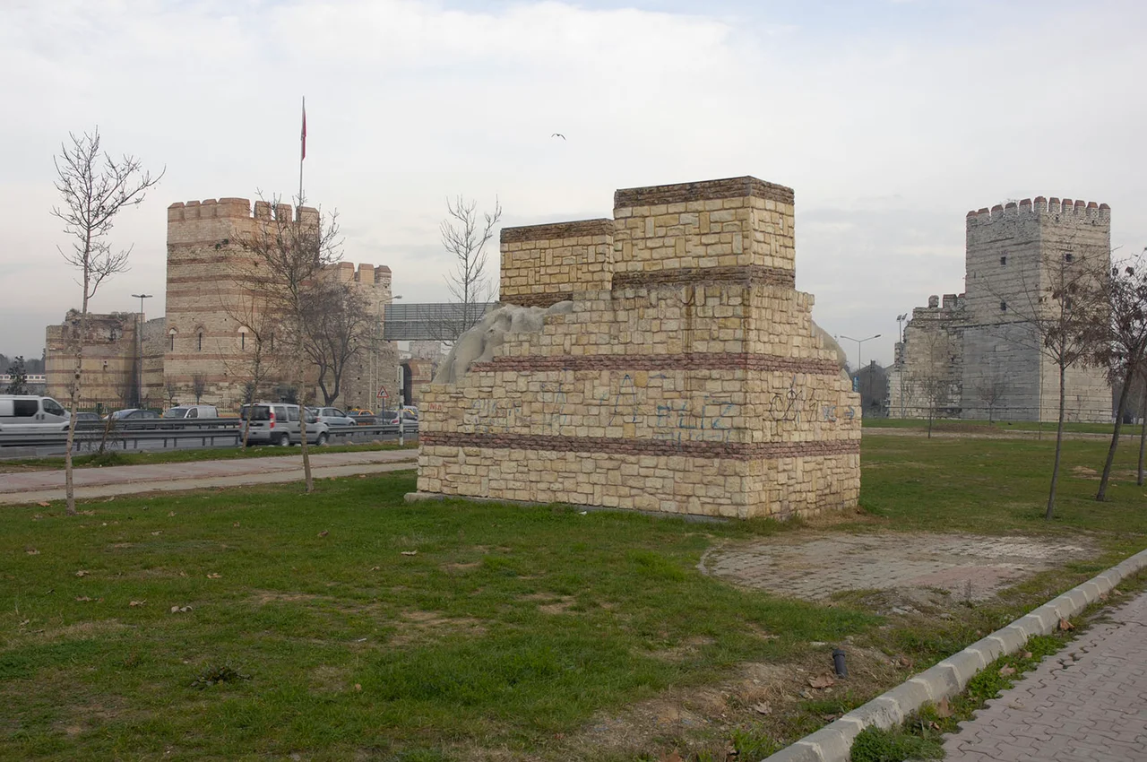

Walls of Constantinople
The Cambridge Ancient History calls them 'perhaps the most successful and influential city walls ever built.' That is not hyperbole; it is the verdict of the math. For more than a millennium, Constantinople stood on a triangular peninsula between the Sea of Marmara and the Golden Horn, reachable overland only from the west — and from the west, for a thousand years, no enemy broke through. Avars came. Arabs came, twice. The Rus came. The Bulgars came. Each time, the walls held. The city survived not because it was unconquerable in some romantic sense, but because engineers in the 5th century had thought with uncommon precision about what it would take to stop an army, and then built exactly that.
A City Remade in Stone
The first walls were not Theodosian. Constantine the Great, who refounded the city as Constantinople — 'New Rome' — in 330, enclosed his expanded capital with a single curtain wall, reinforced by towers at regular intervals, begun in 324 and completed under his son Constantius II. Within a century, the city had already burst those bounds. By the early 5th century, Constantinople had spread west into the extramural zone beyond Constantine's wall, and a new line was needed. The work fell to Anthemius, the praetorian prefect of the East, who built a new single wall during the minority of the young emperor Theodosius II, finished by 413. Then, in 437 and again on 6 November 447, two earthquakes struck in rapid succession, destroying 57 towers and collapsing long sections of the new wall. Attila the Hun was in the Balkans. The city faced a race between destruction and invasion. The chariot-racing factions — the Blues and the Greens, the great rival fan groups of Byzantine Constantinople who could mobilize tens of thousands of men — supplied 16,000 workers between them. According to the Byzantine chroniclers and three inscriptions found in place, the walls were restored in sixty days. What emerged from that frenzy of rebuilding was something far more formidable than what had been lost.
The Triple Line
The finished Theodosian system was not a wall. It was a landscape. Moving west from the city, an attacker first encountered a moat — over 20 meters wide, up to 10 meters deep, with a low crenellated wall along its inner edge serving as a first fighting line. Beyond the moat lay an outer terrace, the peribolos, and then the outer wall: 8.5 to 9 meters high, with 62 surviving towers, each one placed midway between the towers of the inner wall behind it so that archers on both walls could cover the same ground. Then came a second terrace — the inner peribolos — and finally the inner wall itself: 4.5 to 6 meters thick, 12 meters high, faced in carefully cut limestone with a mortar core reinforced by horizontal bands of brick 40 centimeters thick, a technique that also helped it survive earthquakes. Ninety-six towers reinforced the inner wall, most of them square but including some octagonal, three hexagonal, and a single pentagonal one, rising 15 to 20 meters high. Together, the three lines stretched for 5.7 kilometers from the Sea of Marmara to the Golden Horn, with sea walls enclosing the rest of the triangular peninsula. The system had nine main gates and a golden entrance arch — the Golden Gate, built of polished white marble blocks without mortar — through which emperors rode in triumph after victories.
The Sieges They Held
The walls' résumé is extraordinary. In 626, a joint Avar and Sassanid Persian force attacked the city simultaneously by land and sea; the sea assault failed, and the land walls held. In the 670s, Arab fleets attacked for years and were repelled, partly by the walls and partly by Greek fire. In 717–718, a second Arab siege under Maslama ibn Abd al-Malik — a force that by some accounts numbered in the hundreds of thousands — encamped outside the walls for over a year and accomplished nothing; disease and Byzantine naval attacks eventually destroyed the army. Bulgarian forces besieged the city in 813; the walls held. Ottoman forces besieged the city in 1394–1402 and again in 1422 — in the latter attack, artillery was used against the walls but could not breach them. A 16th-century Chinese geographical treatise recorded the city with simple wonder: 'Its city has two walls. A sovereign prince lives in the city.' The walls were so famous they had become a defining fact of the world.
The Weakest Point
Soldiers who knew the walls well understood that one section was different. The Lycus River, a small stream, passed beneath the walls in the valley between the Sixth and Seventh Hills, creating a depression in the terrain where the wall dipped to its lowest point — around 35 meters above sea level — and where the ground outside was flat enough to concentrate artillery. This stretch, which scholars call the Mesoteichion or 'middle wall,' was the obvious target. Every serious attacker studied it. The Gate of St. Romanus, known in Turkish as Topkapı ('Cannon Gate'), sat in this section; the name came from the great Ottoman cannon placed opposite it during the final siege of 1453. Constantine XI Palaiologos, the last Byzantine emperor, established his command post at the Gate of Charisius on the Sixth Hill, the highest point of the old city, commanding a view across the critical stretch below him. For almost two months in the spring of 1453, Sultan Mehmed II's forces bombarded the walls with artillery — including the enormous bronze cannon cast by the Hungarian engineer Urban, firing stone balls reported to weigh up to 600 kilograms — and still did not breach them. The wall absorbed the blows and was repaired each night by the defenders.
The Morning of 29 May 1453
The Ottoman army had besieged Constantinople for nearly seven weeks when the final assault came. The city's garrison, perhaps 7,000 men defending 5.7 kilometers of land wall against a force many times larger, had held. The walls themselves remained unbreached at the end. What gave way was something smaller. A small postern gate called the Kerkoporta, near the northern end of the Theodosian walls, was left open — whether by accident or in the confusion of battle, the sources do not agree. Fifty Ottoman soldiers passed through it. They raised their banner on the inner wall. The Greek defenders in the peribolos below, caught between fire from the banner-bearers above and the main assault from outside, broke. The panic spread along the line. By morning, the city had fallen. Constantine XI, the last emperor of Rome, died in the fighting — where exactly, and whether his body was ever identified, is still disputed. One Greek legend says an angel turned him to marble and hid him in a cave beneath the Golden Gate, where he waits to reclaim the city. Sultan Mehmed II, immediately after the conquest, ordered the walls repaired. He understood what they were worth.
What You See Today
The Theodosian walls run for 5.7 kilometers through the heart of modern Istanbul, a belt of parkland following their course, modern roads piercing them at intervals where the old gates once stood. Many sections were restored in the 1980s with UNESCO support — a program that drew criticism for poor craftsmanship and inappropriate materials. In the 1999 earthquakes, restored sections collapsed while the original 5th-century structure beneath them remained standing. The World Monuments Fund added the walls to its 2008 Watch List of the 100 Most Endangered Sites in the world. Despite that, what survives is remarkable: towers, stretches of inner and outer wall, the moat's outline in the landscape, and the Golden Gate's marble blocks still visible inside the Yedikule Fortress, which Sultan Mehmed II built around the old gate in 1458. You can walk the walls from the Marmara to the Golden Horn — a walk through the entire arc of Byzantine history, from the 5th century to the 15th, embodied in stone.
From the Air
The Theodosian land walls run roughly north–south across the western edge of Istanbul's historic peninsula, from approximately 41.015°N, 28.919°E (Golden Horn end) to 40.991°N, 28.919°E (Marmara coast), with the Yedikule Fortress and the Golden Gate visible at the southern end. From 3,000–5,000 feet on approach from the west, the walls read as a clear dark line cutting across the urban fabric of Fatih district. The Sea of Marmara and the Golden Horn define the city's triangular outline. Nearest airport is Istanbul Airport (LTFM), approximately 30 km to the northwest; the walls are on the direct approach path into the city from Europe.
Nearby Stories
- Kocaeli Peninsula 7.6 km away
- Second Battle of Çatalca 11 km away
- Istanbul's Rural Outskirts 14 km away
- MV Struma 20 km away
- HMAS AE2 36 km away
- Bursa 66 km away
- Sangarius Bridge 71 km away
- Januarius MacGahan 101 km away