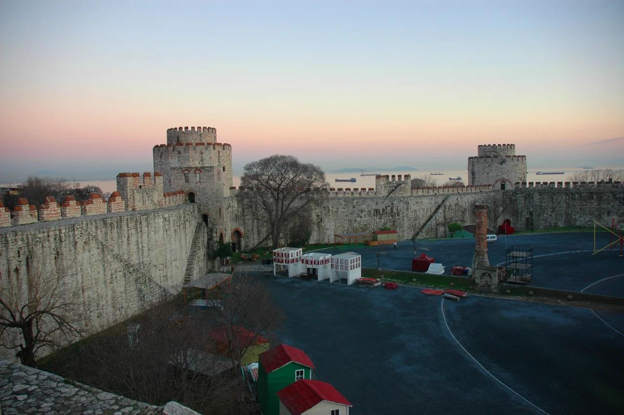

Yedikule
The lettuce of Yedikule was famous. Not tourist-brochure famous — genuinely, practically famous in a city that needed to be fed. For more than fifteen centuries, the bostans of Yedikule — the urban market gardens pressed against and between the great Byzantine walls — grew cabbages and lettuces that supplied Istanbul's markets and households. A guarantor book from 1735 recorded 344 gardens in and around the neighborhood. A city map from a century later counted 102, the number reduced as Istanbul grew but still substantial. The gardens were one of the longest-running examples of urban agriculture in any major city in the world, and the fact that they were eventually largely displaced by roads and residential construction in the 1970s does not diminish what they were: a living system that outlasted empires.
Living Inside the Walls
Yedikule means Seven Towers in Turkish — a name derived directly from the fortress at its center, whose seven-towered silhouette has defined the neighborhood's identity since the Ottoman conquest of Constantinople in 1453. But urbanization of the area began in earnest in the 16th century, when the neighborhood around the fortress began to fill with residents, workshops, gardens, and the kinds of small institutions — fountains, neighborhood mosques, community schools — that gave Ottoman districts their texture. The neighborhood's relationship to its physical boundaries was always intimate: the ancient Theodosian walls were not ruins but working structures, the gardens grew in the strips of land between the wall lines, and the fortress itself was a looming presence at the southwestern edge. Living in Yedikule meant living inside history in a literal sense — the past was not past but present, structural, and very large.
The Bostans and Their Cabbages
The Yedikule urban gardens — the bostans — were a particular kind of Ottoman agricultural institution. Working within the compressed geography of the walled city, gardeners cultivated the land between the inner and outer Byzantine walls and in the open ground nearby, using techniques that had been refined over generations. The soil, enriched by centuries of cultivation and close to the water of the Sea of Marmara, was especially productive. The cabbages and lettuces grown here had a reputation that extended well beyond the neighborhood. The Lettuce Feast — a neighborhood festival celebrating the local harvest — is one marker of how central the gardens were to Yedikule's self-understanding. By the early 20th century, the number of gardens had already declined significantly from the 344 recorded in 1735. The population boom that transformed Istanbul from the 1940s through the 1980s accelerated the loss: gardens became apartment buildings, and part of the remaining land was used in the 1970s for highway construction — the route of Otoyol 1 — and waste-filling. The Municipality of Istanbul has since initiated rehabilitation projects to preserve what remains.
A Mixed Community
Yedikule's population has always been heterogeneous. Through the Ottoman period and into the early 20th century, the neighborhood was home to notable non-Muslim communities — Greek and Armenian families who established churches and community institutions alongside the Muslim majority. The Yedikule Surp Pıgiç Hospital, an Armenian hospital, has operated in the neighborhood for well over a century and a half, a continuous presence that reflects the community that built and sustained it. Greek churches served a congregation that diminished over the course of the 20th century as the population of Istanbul's Greek community contracted sharply. What remains of this pluralism is visible in the neighborhood's architecture — in the churches that still stand, the hospital that still operates — even as the demographics have shifted substantially.
The Fault Under the Garden
Yedikule sits on ground that is, in geological terms, dangerous. The North Anatolian Fault, one of the most seismically active fault zones in the world, passes offshore from Yedikule in the Sea of Marmara. Istanbul is widely understood by geologists and engineers to be at significant risk from a major earthquake on this fault system. The same ground that has been cultivated continuously for fifteen centuries, that supported Byzantine walls and Ottoman gardens and a modern residential neighborhood, rests above one of the world's great tectonic boundaries. This is not a cause for panic but it is a fact that shapes how city planners, engineers, and residents think about the neighborhood's future — including the rehabilitation of its ancient walls, which are seismically vulnerable structures of enormous historical significance.
Yedikule Now
Today Yedikule has a population of roughly 15,789 people and is connected to the rest of Istanbul by the T6/U3 Sirkeci–Kazlıçeşme rail line, with Yedikule station reopening in February 2024. The fortress is a museum; the gasworks is being repurposed as a cultural venue. Mayor Ekrem İmamoğlu, in a statement that acknowledged the neighborhood's long-standing neglect, said he was ashamed that the Yedikule Walls had gone untoured for years and committed the city to doing better. Some of the original garden land survives under municipal protection. The neighborhood retains, despite everything, a character that is slightly separate from the tourist circuits of the historic peninsula — quieter, more residential, more local in its rhythms. The walls are still there. Some of the gardens have come back. The lettuce grows.
From the Air
Yedikule neighborhood is centered at approximately 40.993°N, 28.923°E, in the southwestern corner of Istanbul's historic Fatih district, on the European shore of the Sea of Marmara. From the air, the neighborhood is defined by the unmistakable line of the Byzantine land walls running north from the fortress, with the Marmara coast forming the southern boundary. At 2,000 feet, the geometry of the ancient wall system — double curtain walls, towers, moat — is most legible, as is the strip of land between the walls where the bostans once flourished. Nearest major airport is LTFM (Istanbul Airport), approximately 38 km to the northwest.
Nearby Stories
- Kocaeli Peninsula 7.6 km away
- Second Battle of Çatalca 11 km away
- Istanbul's Rural Outskirts 14 km away
- MV Struma 20 km away
- HMAS AE2 36 km away
- Bursa 66 km away
- Sangarius Bridge 71 km away
- Januarius MacGahan 101 km away